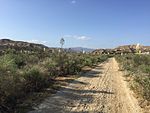
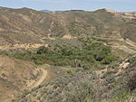
St. Francis Dam

The St. Francis Dam was a concrete gravity dam located in San Francisquito Canyon in northern Los Angeles County, California that was built between 1924 and 1926 to serve the city of Los Angeles's growing water needs. It failed catastrophically in 1928 due to a defective soil foundation and design flaws, unleashing a flood that claimed the lives of at least 431 people. The collapse of the dam is considered to have been one of the worst American civil engineering disasters of the 20th century, and remains the 3rd-greatest loss of life in California's history, exceeded only by the 1906 San Francisco earthquake and fire and the Great Flood of 1862.The St. Francis Dam was built to create a large regulating and storage reservoir that was an integral part of the Los Angeles Aqueduct. It was located in San Francisquito Canyon of the Sierra Pelona Mountains, about 40 miles (64 km) northwest of downtown Los Angeles, and approximately 10 miles (16 km) north of the present day city of Santa Clarita, California. The dam was designed and built by the Los Angeles Department of Water and Power, then named the Bureau of Water Works and Supply. The department was under the direction of its general manager and chief engineer, William Mulholland. The disaster ended Mulholland's career.
Excerpt from the Wikipedia article St. Francis Dam (License: CC BY-SA 3.0, Authors, Images).St. Francis Dam
Forest Route 5N27,
Geographical coordinates (GPS) Address External links Nearby Places Show on map
Geographical coordinates (GPS)
| Latitude | Longitude |
|---|---|
| N 34.546944444444 ° | E -118.5125 ° |
Address
St. Francis Dam
Forest Route 5N27
California, United States
Open on Google Maps


