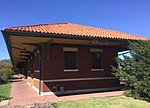
De Graff, Kansas
Kansas geography stubsUnincorporated communities in Butler County, KansasUnincorporated communities in KansasUse mdy dates from July 2023

De Graff is an unincorporated community in Butler County, Kansas, United States. It is located on U.S. Route 77 approximately 7.7 miles (12.4 km) north of I-35 (Kansas Turnpike)
Excerpt from the Wikipedia article De Graff, Kansas (License: CC BY-SA 3.0, Authors, Images).De Graff, Kansas
Trumball Road,
Geographical coordinates (GPS) Address Nearby Places Show on map
Geographical coordinates (GPS)
| Latitude | Longitude |
|---|---|
| N 37.981111111111 ° | E -96.862777777778 ° |
Address
Trumball Road
Trumball Road
66840
Kansas, United States
Open on Google Maps


