place

Park Vale Academy

Academies in NottinghamSecondary schools in Nottingham

Park Vale Academy (formerly Top Valley School and Top Valley Academy) is a mixed secondary school located in the Top Valley area of Nottingham in the English county of Nottinghamshire.

Excerpt from the Wikipedia article Park Vale Academy (License: CC BY-SA 3.0, Authors).

Park Vale Academy
Top Valley Drive, Nottingham Top Valley

Geographical coordinates (GPS) Address Phone number Website Nearby Places
placeShow on map

Wikipedia: Park Vale AcademyContinue reading on Wikipedia

Geographical coordinates (GPS)

Latitude Longitude
N 53.0088 ° E -1.1772 °
placeShow on map

Address

Park Vale Academy

Top Valley Drive
NG5 9AZ Nottingham, Top Valley
England, United Kingdom
mapOpen on Google Maps

Phone number
Redhill Academy Trust

call+441158221244

Website
parkvaleacademy.org.uk

linkVisit website

Share experience

Nearby Places

Rise Park, Nottingham

Rise Park is a suburb of Nottingham four miles north of the City Centre and three miles north-east of junction 26 of the M1 motorway. It comprises approximately 1500 homes, primarily privately owned houses and bungalows, and a small number of low rise, three-storey flats. Construction of the estate began in the early 1960s, starting at the bottom of the hill to the west and gradually spreading upwards and eastwards to be completed in the early 1970s. It was built on the former site of Rise Farm (known as Bulwellrise Farm until around 1900), the southern boundary of which ran along the edge of what is now Rise Park Road, Langbank Avenue and Bracadale Road. The farmhouse had stood on what would now be the south-east corner of Haverill Crescent. On the western boundary ran a railway line, closed in the mid-1960s and now a tree-lined footpath. To the north is Bestwood Country Park and to the east is another housing estate built in the late 1970s on the site of Home Farm. Rise Park primary and nursery school was originally opened as separate infant and junior schools in 1971, built on land once belonging to Top Valley Farm, as was Top Valley Academy which opened in September 1973. Rise Park has had a small parade of shops since 1969 or 1970. An additional supermarket (originally Grandways and later Kwik-Save) opened for business in 1977 but this was later demolished and replaced with McCracken Close and new homes in the 2010s. Next to the shopping area is a church opened in 1968 and a bus terminus with frequent links to the City Centre and surrounding areas of Arnold and Bulwell. The market town of Hucknall is close by.

Top Valley

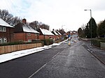
Top Valley is a largely residential area in the north west of Nottingham, England. It is located to the south of Rise Park, to the north and west of Bestwood, to the southwest of Bestwood Village and to the east of Bulwell. It is approximately 4 miles from Nottingham city centre. The estate was built in the 1970s on the grounds of Top Valley farm, Forest farm and Home farm. For the most part construction progressed from west to east with the first houses appearing before the end of 1972. The Top Valley farmhouse was knocked down in 1973 and replaced with Knights Close whilst the Forest farmhouse had stood at the south-west corner of what is now Brisbane Drive. In late 1982 a Tesco supermarket was opened on the former site of the railway wagon works south of Top Valley Way, the railway line itself having closed in the mid-1960s and now a tree-lined footpath on the western boundary of the estate. The original supermarket building was demolished and replaced with a larger construction circa 2005/06. Another notable change occurred during the 2010s in the Bakewell Drive area with several dwellings demolished and replaced with modern housing. In early 2018 the former children's home at Ranskill Gardens was demolished (having closed in the late 2000s). Eight new 'ecohomes' are being built on the site by Positive Homes - all to 'A' rated Energy Performance Certificate Standards, making them among the most energy efficient homes in the UK. This is set to be followed in 2019 by a large ecohome development on the former Eastglade Primary School site by Nottingham City Homes.

Bulwell Forest tram stop

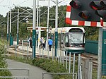
Bulwell Forest is a tram stop on the Nottingham Express Transit (NET) light rail system in the city of Nottingham in the suburb of Bulwell. It is part of the NET's initial system, and is situated on the long single line section between Bulwell and Hucknall tram stops that runs alongside the Robin Hood railway line. Like all the other intermediate stops on this section, the stop has a passing loop with an island platform situated between the two tracks of the loop.With the opening of NET's phase two, Bulwell Forest is now on NET line 1, which runs from Hucknall through the city centre to Beeston and Chilwell. Trams run at frequencies that vary between 4 and 8 trams per hour, depending on the day and time of day.The tram stop should not be confused with the former Bulwell Forest railway station, which was situated on the, now closed, Great Northern Railway's Nottingham to Shirebrook line, some 750 metres (2,460 ft) to the south-east of the tram stop. The Robin Hood line that passes alongside the stop was originally the former Midland Railway route from Nottingham to Worksop, but there has never been a railway station at the stop's location.There is a road level crossing just to the south of the tram stop, and pedestrian access to the stop is from this crossing. At the crossing, both tram and railway lines are protected by the automatic barriers. The Springfield Retail Park, containing branches of Morrisons, Matalan, Wickes and Brantano, is adjacent to the tram stop.