place

Hotel Arbez

France–Switzerland borderFrance–Switzerland border crossingsHotels in FranceHotels in Switzerland
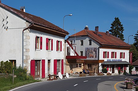
La Cure Douane
La Cure Douane

The Hotel Arbez, also called the Hôtel Arbez Franco-Suisse or l’Arbézie, is a hotel that straddles the international border between France and Switzerland in the tiny village of La Cure, which is itself divided by the boundary. Built by a private landowner and businessman specially to take advantage of an impending border adjustment between the two countries, the structure was originally used as a grocery store (its Swiss portion) and a pub (the French half). Today, the entire building houses a hotel, whose dining room, kitchen and several rooms are bisected by the boundary.

Excerpt from the Wikipedia article Hotel Arbez (License: CC BY-SA 3.0, Authors, Images).

Hotel Arbez
Rue de la Frontière, Saint-Claude

Geographical coordinates (GPS) Address External links Nearby Places
placeShow on map

Wikipedia: Hotel ArbezContinue reading on Wikipedia

Geographical coordinates (GPS)

Latitude Longitude
N 46.4643 ° E 6.073 °
placeShow on map

Address

Hôtel Restaurant Arbez Franco-Suisse (Franco-Suisse)

Rue de la Frontière 601
39220 Saint-Claude
Bourgogne-Franche-Comté, France
mapOpen on Google Maps

linkWikiData (Q16892486)
linkOpenStreetMap (102786964)

La Cure Douane
La Cure Douane
Share experience

Nearby Places

La Dôle
La Dôle

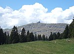
La Dôle is a mountain of the Jura, overlooking Lake Geneva in the westernmost part of the canton of Vaud. Rising to an altitude of 1677 meters, it is the second highest peak in the Swiss portion of the Jura, after Mont Tendre. Administratively, the summit is split between the municipalities of Gingins, Chéserex and La Rippe. The mountain is also close to and easily accessible from Saint-Cergue and the Col de la Givrine to the north, both above 1000 meters and connected to Nyon on Lake Geneva by road and by the Nyon–St-Cergue–Morez Railway. A paved road also climbs to the Chalet de la Dôle below the summit (1439 m) from Gingins.La Dôle overlooks to south-east the summit of La Barillette, the town of Nyon, Lake Geneva and across the lake the Alps, including the Bernese Alps the Chablais Alps and the Mont Blanc massif. To the south are views of the City of Geneva and the Canton of Geneva; to the north the village of Les Rousses. The Dôle massif has a second peak to the northeast, the Pointe de Poêle Chaud, accessible via the col between them which drops to 1557 m. La Dôle massif is the northwesternmost part of the Swiss Plateau. To the southwest it ends at the Col de la Faucille, and to the northwest at the Valserine valley, a Rhône tributary. To the north it ends at the Col de la Givrine, and towards the southeast merges into the Swiss Plateau. The northwestern side of La Dôle is equipped with ski-lifts and is traversed by alpine ski paths. There is a restricted-access cable car which provides service to the various electronic facilities on the top, including a ball containing aviation radar, a Swiss weather station, television, radio and EBU telecommunications.