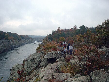
Billy Goat Trail
1919 establishments in MarylandAC with 0 elementsChesapeake and Ohio Canal National Historical ParkHiking trails in MarylandNational Park Service areas in Maryland ... and 2 more
Protected areas established in 1919Protected areas of Montgomery County, Maryland

The Billy Goat Trail is a 4.7-mile (7.6 km) hiking trail that follows a path between the C&O Canal and the Potomac River within the Chesapeake and Ohio Canal National Historical Park near the Great Falls in Montgomery County, Maryland. The trail has three sections: Section A, the northernmost, is 1.7 miles (2.7 km); Section B is 1.4 miles (2.3 km); and Section C, the southernmost, is 1.6 miles (2.6 km)
Excerpt from the Wikipedia article Billy Goat Trail (License: CC BY-SA 3.0, Authors, Images).Billy Goat Trail
Chesapeake and Ohio Canal Trail,
Geographical coordinates (GPS) Address Nearby Places Show on map
Geographical coordinates (GPS)
| Latitude | Longitude |
|---|---|
| N 38.9938 ° | E -77.2458 ° |
Address
Chesapeake and Ohio Canal Trail
Chesapeake and Ohio Canal Trail
Maryland, United States
Open on Google Maps


