place

Kfar Kedem

1992 establishments in IsraelLiving museumsOpen-air museumsOutdoor structures in IsraelParks in Israel
Tourism in IsraelTourist attractions in IsraelTourist attractions in Northern District (Israel)
Visitors in Kfar Kedem

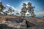
Kfar Kedem (Hebrew: כפר קדם) is a tourist center in Israel which reconstructs the everyday life in the Galilee 2000 years ago, during the Mishnah period. Kfar Kedem is located on Route 77, next to the Hamovil intersection. It was established in 1992 in the Hoshaya settlement by Menachem Goldberg. The center includes about 4 acres of vegetation and trees native to the ancient Land of Israel. The site reconstructs Jewish life in the Galilee during the Mishnah period. It is located next to Sepphoris, which was the home base of the Sanhedrin (the highest Jewish religious court), its scholars [rabbis], and their leader, Judah the Prince, one of the compilers of the Mishnah. The site opened in 1992. All visitors start the tour with a short lecture, and immediately afterwards they don Tzitzit, a 4-cornered shawl and a scarf to cover their heads.

Excerpt from the Wikipedia article Kfar Kedem (License: CC BY-SA 3.0, Authors, Images).

Kfar Kedem
Emek Izrael Regional Council

Geographical coordinates (GPS) Address Nearby Places
placeShow on map

Wikipedia: Kfar KedemContinue reading on Wikipedia

Geographical coordinates (GPS)

Latitude Longitude
N 32.756833333333 ° E 35.299083333333 °
placeShow on map

Address


Emek Izrael Regional Council
North District, Israel
mapOpen on Google Maps

Visitors in Kfar Kedem
Share experience

Nearby Places

Sepphoris
Sepphoris

Sepphoris ( sif-OR-iss; Ancient Greek: Σέπφωρις, romanized: Sépphōris), known in Hebrew as Tzipori (צִפּוֹרִי) and in Arabic as Saffuriya (صفورية Ṣaffūriya) since the 7th century, is an archaeological site located in the central Galilee region of Israel, 6 kilometres (3.7 mi) north-northwest of Nazareth. It lies 286 meters (938 ft) above sea level and overlooks the Beit Netofa Valley. The site holds a rich and diverse historical and architectural legacy that includes Hellenistic, ancient Jewish, Roman, Byzantine, early Islamic, Crusader, Mamluk and Ottoman remains. In the Roman period, it was also called Diocaesaraea. In Mandatory Palestine, Saffuriya was a Palestinian Arab town with a population of approximately 5000 people at the time of its depopulation in 1948. Since Late Antiquity, it was believed to be the birthplace of Mary, mother of Jesus, and the village where Saints Anna and Joachim are often said to have resided, where today a fifth-century basilica is excavated at the site honouring the birth of Mary. Notable structures at the site include a Roman theatre, two early Christian churches, a Crusader fort partly rebuilt by Zahir al-Umar in the 18th century, and over sixty different mosaics dating from the third to the sixth century CE. Following the Bar Kokhba revolt of 132–135, Sepphoris was one of the Galilean centers where rabbinical families from neighboring Judea relocated. Remains of a synagogue dated to the first half of the fifth century were discovered on the northern side of town. In the 7th century, the town was conquered by the Arab Rashidun armies during the Muslim conquest of the Levant. Successive Muslim dynasties ruled the area until the Crusades. Until its depopulation during the 1948 Arab–Israeli War, Saffuriya was a Palestinian Arab village. Moshav Tzippori was established adjacent to the site in 1949. It falls under the jurisdiction of Jezreel Valley Regional Council, and in 2021 had a population of 1,014. The area where the remains of the ancient city have been excavated, occupied until 1948 by the Arab village, was designated an archaeological reserve named Tzipori National Park in 1992.