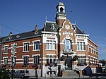
Mélantois
Nord (French department)Nord (French department) geography stubs
The Mélantois (French pronunciation: [melɑ̃twa]) is an inland area of northern France, at south-east of Lille. Between the Deûle and the Marque, it is bounded to the north by a line from Willems to La Madeleine. It is a chalky plateau at an altitude of between 20 to 45 metres (66 to 148 ft), with gentle slopes (below 5 %).
Excerpt from the Wikipedia article Mélantois (License: CC BY-SA 3.0, Authors).Mélantois
Rue Jean Rostand, Lille
Geographical coordinates (GPS) Address Nearby Places Show on map
Geographical coordinates (GPS)
| Latitude | Longitude |
|---|---|
| N 50.5833 ° | E 3.0833 ° |
Address
Rue Jean Rostand
59155 Lille
Hauts-de-France, France
Open on Google Maps


