Merton, Devon

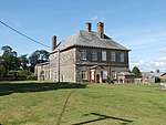
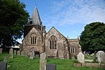
Merton is a village, ecclesiastical parish, former manor and civil parish administered by the local government district of Torridge, Devon, England. The parish, which lies about five miles south east of the town of Great Torrington, is surrounded clockwise from the north by the parishes of Little Torrington, Beaford, Dolton, Huish, Petrockstowe and Peters Marland. In 2001 its population was 331, down from the 507 residents it had in 1901. The eastern and northern boundaries of the parish follow the loops of the River Torridge and the other sides are defined by the River Mere. The village forms part of the electoral ward of Clinton. The population at the 2011 census was 1,537.The village is on the A386 road between Meeth and Great Torrington. The parish church, on the west side of the village, is dedicated to All Saints and dates from around 1400. It suffered a heavy Victorian restoration between 1872 and 1875 by R. M. Fulford, but the east window of the north chapel retains many fragments of late medieval stained glass. Speccot, Dunsbear and Potheridge were estates mentioned in the Domesday Book of 1086.
Excerpt from the Wikipedia article Merton, Devon (License: CC BY-SA 3.0, Authors, Images).Merton, Devon
Clinton Gardens, Torridge District Merton
Geographical coordinates (GPS) Address Nearby Places Show on map
Geographical coordinates (GPS)
| Latitude | Longitude |
|---|---|
| N 50.891 ° | E -4.094 ° |
Address
Clinton Gardens
Clinton Gardens
EX20 3DP Torridge District, Merton
England, United Kingdom
Open on Google Maps


