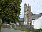
St Giles on the Heath

St Giles on the Heath, sometimes hyphenated as St Giles-on-the-Heath, is a village and civil parish in the far west of Devon, England. It forms part of the local government district of Torridge. The village is in the east of the parish and lies on the A388 road about eight miles south of the town of Holsworthy. The parish includes the hamlets of Hele, West Panson, East Panson, Sitcott, Box's Shop, Peter's Finger, West Druxton, Poole and Netherbridge. The parish is surrounded clockwise from the north-west by the parishes of Northcott, Luffincott, Ashwater, Virginstow, Broadwoodwidger and Lifton. Its western border follows the River Tamar which forms the county boundary with Cornwall. In 2001 its population was 617, significantly higher than the 258 residents it had in 1901. The village is part of Broadheath electoral ward. At the 2011 census the population was 1,650.
Excerpt from the Wikipedia article St Giles on the Heath (License: CC BY-SA 3.0, Authors, Images).St Giles on the Heath
Moorfield Road, Torridge District St. Giles on the Heath
Geographical coordinates (GPS) Address Nearby Places Show on map
Geographical coordinates (GPS)
| Latitude | Longitude |
|---|---|
| N 50.689 ° | E -4.32 ° |
Address
Moorfield Road
Moorfield Road
PL15 9SY Torridge District, St. Giles on the Heath
England, United Kingdom
Open on Google Maps


