place

Dorval—Lachine—LaSalle

2013 establishments in QuebecCanElecResTopTest with bare yearCanadian constituency stubsDorvalFederal electoral districts of Montreal
LaSalle, QuebecLachine, QuebecUse Canadian English from January 2023Use mdy dates from November 2021
Dorval—Lachine—LaSalle (Canadian electoral district)

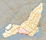
Dorval—Lachine—LaSalle is a federal electoral district on Montreal Island in Quebec. It encompasses a portion of Quebec formerly included in the electoral districts of LaSalle—Émard and Notre-Dame-de-Grâce—Lachine.Dorval—Lachine—LaSalle was created by the 2012 federal electoral boundaries redistribution and was legally defined in the 2013 representation order. It came into effect upon the call of the 2015 Canadian federal election, which took place October 19, 2015.The riding was originally intended to be named Dorval—Lachine.

Excerpt from the Wikipedia article Dorval—Lachine—LaSalle (License: CC BY-SA 3.0, Authors, Images).

Dorval—Lachine—LaSalle
Rue Provost, Montreal Lachine

Geographical coordinates (GPS) Address Nearby Places
placeShow on map

Wikipedia: Dorval—Lachine—LaSalleContinue reading on Wikipedia

Geographical coordinates (GPS)

Latitude Longitude
N 45.441666666667 ° E -73.683333333333 °
placeShow on map

Address

Rue Provost 2115
H8S 0B2 Montreal, Lachine
Quebec, Canada
mapOpen on Google Maps

Dorval—Lachine—LaSalle (Canadian electoral district)
Share experience

Nearby Places

The Fur Trade at Lachine National Historic Site

The Fur Trade at Lachine National Historic Site (Lieu historique national de la Commerce-de-la-Fourrure-à-Lachine) is a historic building located in the borough of Lachine in Montreal, Quebec, Canada, at the western end of the Lachine Canal. It is a National Historic Site of Canada.Beginning in the 17th century, voyageurs would launch their canoes from this location to transport trade goods thousands of miles into the interior of North America lands. At that time the Lachine Rapids prevented large ships from going any further west along the Saint Lawrence River. A stone warehouse was erected in 1803 to store the furs gathered as a result of fur trade. It is now a Parks Canada museum dedicated to the history of this strategic location as a departure and arrival point for fur trading expeditions. The site is separate from Lachine Canal National Historic Site, with which it is inextricably connected. Montreal was the start of nearly all westward canoe routes. See Canadian canoe routes (early). Here furs were transferred from canoe to ship and trade goods from ship to canoe. A natural transfer point was the west end of Montreal Island since goods could be carted over a nine-mile road around the Lachine Rapids. Canoes usually left in May and returned in August. The Northwest Company built a stone warehouse here in 1803. It was used until 1859 when it was sold to the Sisters of Sainte Anne who used it as an employee residence. The Lachine Canal was built around the rapids in 1825. Sir George Simpson (administrator) had a mansion across the canal from the warehouse which was torn down in 1880. Parks Canada acquired the warehouse in 1977 and in 1985 opened a museum.

Kahnawake
Kahnawake

The Kahnawake Mohawk Territory (French: Territoire Mohawk de Kahnawake, pronounced [ɡahnaˈwaːɡe] in the Mohawk language, Kahnawáˀkye in Tuscarora) is a First Nations reserve of the Mohawks of Kahnawá:ke on the south shore of the Saint Lawrence River in Quebec, Canada, across from Montreal. Established by French Canadians in 1719 as a Jesuit mission, it has also been known as Seigneury Sault du St-Louis, and Caughnawaga (after a Mohawk village in the Mohawk Valley of New York). There are 17 European spelling variations of the Mohawk Kahnawake. Kahnawake's territory totals an area of 48.05 km2 (18.55 sq mi). Its resident population numbers slightly above 8,000, with a significant number living off reserve. Its land base today is unevenly distributed due to the federal Indian Act, which governs individual land possession. It has rules that are different from those applying to Canadian non-reserve areas. Most Kahnawake residents originally spoke the Mohawk language, and some learned French when trading with and allied with French colonists. Together with most of four Iroquois nations, including the Mohawk, they allied with the British government during the American Revolutionary War and the Lower Canada Rebellion. They have since become mostly English speaking. Although people of European descent traditionally refer to the residents of Kahnawake as Mohawk, their autonym is Kanien’kehá:ka (the "People of the Flint"). Another meaning is "those who speak [the language] Kanien'kéha"). The Kanien’kehá:ka were historically the most easterly nation of the Haudenosaunee (Six Nations Iroquois Confederacy) and are known as the "Keepers of the Eastern Door". They controlled territory on both sides of the Mohawk River and west of the Hudson River in present-day New York, where they protected other parts of the confederacy to the west against invasion by tribes from present-day New England and the coastal areas. Kahnawake is one of several self-governing Kanien’kehá:ka territories of the Mohawk Nation within the borders of Canada, including Kanesatake on the north shore of the Saint Lawrence River northwest of Montreal; Tyendinaga in Ontario; Akwesasne, which straddles the borders of Quebec, Ontario and New York across the Saint Lawrence River; and the Six Nations of the Grand River in Ontario north of Lake Erie. In the late 18th and early 19th centuries, the British considered Kahnawake one of the Seven Nations of Canada. The name is derived from the Mohawk word kahnawà:ke, meaning "place of the rapids", referring to their major village Caughnawaga near the rapids of the Mohawk River in what is today central New York. When converted Catholic Mohawk moved to the Montreal area, they named the new settlement after their former one. The proximity of the Lachine Rapids also influenced their naming decision.