place

St Stephen's, Gloucester Road

1867 establishments in the United Kingdom19th-century Church of England church buildingsAnglo-Catholic church buildings in the Royal Borough of Kensington and ChelseaAnglo-Catholic churches in England receiving AEOChurch of England church buildings in the Royal Borough of Kensington and Chelsea
Churches completed in 1867Incomplete lists from April 2022
St Stephen, Gloucester Road, London SW7 geograph.org.uk 1509314

St Stephen's Church, Gloucester Road, is a Grade II* listed Anglican church located on the corner of Gloucester Road and Southwell Gardens in South Kensington, London, England.

Excerpt from the Wikipedia article St Stephen's, Gloucester Road (License: CC BY-SA 3.0, Authors, Images).

St Stephen's, Gloucester Road
Gloucester Road, London South Kensington (Royal Borough of Kensington and Chelsea)

Geographical coordinates (GPS) Address Website External links Nearby Places
placeShow on map

Wikipedia: St Stephen's, Gloucester RoadContinue reading on Wikipedia

Geographical coordinates (GPS)

Latitude Longitude
N 51.4957 ° E -0.1836 °
placeShow on map

Address

Parish Church of St. Stephen

Gloucester Road
SW7 4PH London, South Kensington (Royal Borough of Kensington and Chelsea)
England, United Kingdom
mapOpen on Google Maps

Website
saint-stephen.org.uk

linkVisit website

linkWikiData (Q15139003)
linkOpenStreetMap (80693034)

St Stephen, Gloucester Road, London SW7 geograph.org.uk 1509314
Share experience

Nearby Places

Cromwell Road
Cromwell Road

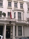
Cromwell Road is a major London road in the Royal Borough of Kensington and Chelsea, designated as part of the A4. It was created in the 19th century and is said to be named after Richard Cromwell, son of Oliver Cromwell, who once owned a house there.The Security Service (MI5) was based at 35 Cromwell Road from 1929 to 1934.Cromwell Road was not always the main traffic route it is now, as when it was built, it ended at Earls Court. The Cromwell Road extension, across the West London railway line and towards Hammersmith, was authorised as a bridge across the railway in 1884 but completed only in 1941. Thus, it was only after the Second World War that it became the main A4 route into London. The large traffic increase brought much demolition and road rearrangement beyond Earls Court Road in 1967 to 1972, but the main part of Cromwell Road has not had its basic building line changed. The 1.5 miles (2.4 km) road starts as West Cromwell Road, near West Kensington Underground station, and continues eastwards from Talgarth Road. It becomes Cromwell Road proper as it crosses Earl's Court Road. It goes just south of Cromwell Hospital and then past Gloucester Road and Gloucester Road Underground station. The next major crossroads comes at the intersection with Queen's Gate, on the corner of which stands Baden-Powell House, the former headquarters of The Scout Association. The road then passes to the south of a museum-academic complex, informally known as Albertopolis, including the Natural History Museum, the Science Museum, Imperial College London and the Victoria and Albert Museum, near South Kensington Underground station. Near this complex, at the junction with Exhibition Road, it becomes Cromwell Gardens for a short stretch before it joins Brompton Road. There are also two embassies located on the road: the Embassy of Yemen in London at 57 Cromwell Road, opposite the Natural History Museum, and the Embassy of Venezuela. France also maintain several buildings on the road, including the Consular Section of the French embassy. The Republic of Ireland maintains a Passport and Visa Section at 114A. The West London Air Terminal was also located on the road.

Cornwall Gardens
Cornwall Gardens

Cornwall Gardens is a long narrow garden square in South Kensington, London, England. The street runs east–west off Gloucester Road and crosses Launceston Place. The ownership of the holdings and land of what is now Cornwall gardens can be traced back to the sixteenth century, Anciently, the thin block of land stretching westwards from Gloucester Road to the Edwardes estate comprised two copyholds belonging to the manor of Earl's Court, amounting together to nearly eleven acres. The smaller portion next to Gloucester Road (formerly Hogmore or Hogmire Lane) was known as Church Close, the larger, more westerly portion as Long Mead, and the division between them was an old footpath, Love Lane, now represented by the line of Launceston Place and Grenville Place and its continuation through Cornwall Gardens. By 1680 they were in the same hands. Purchased by John Broadwood in the early 1800s, it continued as a market garden until it came into possession of Thomas Broadwood Junior (1821-81) in 1844. Under the instruction of Broadwood, it was developed from 1862 to 1879 by (1862–76) Welchman and Gale from 1862 to 1876 and from 1876 to 1879 by William Willett. The buildings of Cornwall Gardens are listed Grade II on the National Heritage List for England in groups as 6–16, 17–44, 55–82, and 83–93. The pair of houses at the west end of the middle of the garden square, Cornwall House and Garden House, are jointly listed Grade II, as are the railings that surround the houses.The 1860s Penfold pillar box on the north side of the gardens is listed Grade II.Stanford court, 45 is an elegant 1930s block home to several eminent residents. Kynance Mews to the north of the square was originally built as stabling for the Cornwall Gardens development between 1862 and 1879.