place

Misericórdia

Lisbon geography stubsMisericórdiaParishes of Lisbon
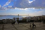
Miradouro de São Pedro de Alcântara Lisboa Portugal (26851722910) (cropped)

Misericórdia (Portuguese pronunciation: [ˌmizɨɾiˈkɔɾdjɐ]) is a freguesia (civil parish) and district of Lisbon, the capital of Portugal. Located in the historic center of Lisbon, Misericórdia is to the east of Estrela, west of Santa Maria Maior, and south of Santo António. It is home to numerous famous neighborhoods, including Bairro Alto, Príncipe Real, and parts of Chiado. The population in 2011 was 13,044.

Excerpt from the Wikipedia article Misericórdia (License: CC BY-SA 3.0, Authors, Images).

Misericórdia
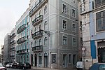
Calçada do Combro, Lisbon Bairro Alto (Misericórdia)

Geographical coordinates (GPS) Address Nearby Places
placeShow on map

Wikipedia: MisericórdiaContinue reading on Wikipedia

Geographical coordinates (GPS)

Latitude Longitude
N 38.711 ° E -9.148 °
placeShow on map

Address

Calçada do Combro 76-82
1200-115 Lisbon, Bairro Alto (Misericórdia)
Portugal
mapOpen on Google Maps

Miradouro de São Pedro de Alcântara Lisboa Portugal (26851722910) (cropped)
Share experience

Nearby Places

Bairro Alto
Bairro Alto

Bairro Alto (Portuguese pronunciation: [ˈbajʁu ˈaɫtu]; literally: Upper District) is a central district of the city of Lisbon, the Portuguese capital. Unlike many of the civil parishes of Lisbon, this region can be commonly explained as a loose association of neighbourhoods, with no formal local political authority but social and historical significance to the urban community of Lisbon and of Portugal as a whole. The bairro or "neighbourhood" resulted from urban expansion in the 16th century, forming outside the walls of the historical city, and is characterized by an almost orthogonal tract (developing from two phases of distinct urbanization).It is a fundamental quarter of Lisbon, organized into a hierarchical scheme of roads and lanes: the roads, the structural axis, run perpendicular to the river; and the lanes, or secondary axis, cut parallel to the river. The matrix of allotments reflects the persistent use of the medieval layout; the division and multiplication of this module had its origin in the variations of the architectural typology. The space constructed is dominated by living spaces implanted in long narrow lots, three to four storeys in height, with asymmetric facades consisting of windows along the various storeys and staircases along the lateral flanks. Although less representative, the Pombaline-era buildings are common, essentially introducing modifications to the level of the façade's composition. Although there are many typological variations to the facade designs, certain elements are repeated, such as the corners, bay and sill windows, eaves and attics, securing a homogeneous urbanized front.