place

Mount Jackson Historic District

Federal architecture in VirginiaGothic Revival architecture in VirginiaHistoric districts in Shenandoah County, VirginiaHistoric districts on the National Register of Historic Places in VirginiaMount Jackson, Virginia
NRHP infobox with nocatNational Register of Historic Places in Shenandoah County, VirginiaQueen Anne architecture in VirginiaShenandoah Valley, Virginia Registered Historic Place stubsUse mdy dates from August 2023
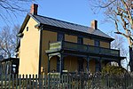
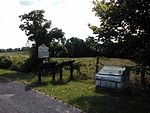
Mt Jackson VA USA Historic District Sept 2013

Mount Jackson Historic District is a national historic district located at Mount Jackson, Shenandoah County, Virginia. Mount Jackson became relatively wealthy because of its location, at the intersection of a major north–south road across the Shenandoah Valley and an east–west creek, with a mill and later a railroad line fostering development. The town saw significant fighting in the American Civil War, and was occupied by soldiers of both armies at various times. Historic buildings range from the historic nondenominational Union Church (built 1825) and cemetery (which contains the grave of Revolutionary War veteran Daniel Gray and others to modern times), to the site of a former Confederate Hospital north of town (on the historic road to Winchester and later Frederick, Maryland) and Union encampment at Rude's Hill about three miles south of town. The district encompasses 125 contributing buildings, 1 contributing site, and 2 contributing structures in the town of Mount Jackson. It includes a variety of commercial, residential, and institutional buildings dating primarily from the late-19th to the early-20th century, the era of the town's greatest prosperity. They are in a variety of popular architectural styles including Gothic Revival, Federal, and Queen Anne. Other notable buildings include the Stoneburner House, Tisinger House, S. P. Lonas House, Brill Building, Lonas Store, former Peoples Bank (c. 1904), Mt. Jackson Volunteer Fire Department (1936), Mt. Jackson Theatre Building (1938), St. Andrew's Episcopal Church (1876), Mt. Jackson Methodist Episcopal Church (1884), and Triplett Middle School (1925).The historic district was listed on the National Register of Historic Places in 1993.

Excerpt from the Wikipedia article Mount Jackson Historic District (License: CC BY-SA 3.0, Authors, Images).

Mount Jackson Historic District
Orkney Drive,

Geographical coordinates (GPS) Address Nearby Places
placeShow on map

Wikipedia: Mount Jackson Historic DistrictContinue reading on Wikipedia

Geographical coordinates (GPS)

Latitude Longitude
N 38.745555555556 ° E -78.643055555556 °
placeShow on map

Address

Orkney Drive 118
22842
Virginia, United States
mapOpen on Google Maps

Mt Jackson VA USA Historic District Sept 2013
Share experience

Nearby Places

Rude's Hill
Rude's Hill

Rude's Hill is a 981-foot hill just outside of the town of Mt. Jackson in Shenandoah County, Virginia, United States, primarily known because it was a strategically placed elevation on which many Civil War events occurred. It was named after the Danish Lutheran minister Anders Rudolph Rude, who arrived in the US in 1836 and married the widow of the Steenbergen plantation. They inhabited a house on the hill called "Locust Grove" which dates to 1792, according to county records. As of July 2014 when the property was for sale, "Locust Grove" was in severely neglected condition with several ungainly exterior modifications over the years, but was still standing. Rude's Hill was an important site in the American Civil War, occupying a commanding high point overlooking the key Valley Turnpike where is passes through a point between Smith Creek on the east and the North Fork of the Shenandoah River on the western side. Rude's Hill is the first elevation on that route beyond the flat Meems bottomland on the south end of the town of Mt. Jackson. It was a particularly defensible high ground because the only practical enemy approach to Rude's Hill was from the north was via single bridges spanning Mill Creek and the Shenandoah's north fork, after which an enemy would need to cross the broad, flat Meems Bottom, commanded by Rude's Hill beyond. And also because if required to retreat, a force could withdraw from Rude's Hill through mountain passes of the Massanutten Range. Because of its strategic placement and high ground location on the Valley Pike and the fact the area had so much action between 1862 and 1865, Rude's Hill figured prominently in the Civil War history of the Shenandoah Valley.