Petit Ballon
Haut-Rhin geography stubsMountains of Haut-RhinMountains of the VosgesOne-thousanders of France

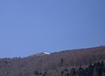
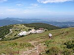
The Petit Ballon (German: Kleiner Belchen) or Little Belchen, is, at 1272m, one of the highest peaks of the Vosges Mountains in the department of Haut-Rhin, Alsace in France, about 5 km away from the village of Wasserbourg. The Rothenbrunnen mountain hut is 500m below. A car park is a further 500m away. The Col du Petit Ballon pass (elevation 1,163 m (3,816 ft)) is close to the summit. The mountain is part of the Belchen System, a group of mountains with the name "Belchen" (in German) that may have been part of a Celtic sun calendar.
Excerpt from the Wikipedia article Petit Ballon (License: CC BY-SA 3.0, Authors, Images).Petit Ballon
Chemin de la Mullermatt, Thann-Guebwiller
Geographical coordinates (GPS) Address Nearby Places Show on map
Geographical coordinates (GPS)
| Latitude | Longitude |
|---|---|
| N 47.980555555556 ° | E 7.1261111111111 ° |
Address
Marie de Buhl
Chemin de la Mullermatt
68610 Thann-Guebwiller
Grand Est, France
Open on Google Maps


