Rhön Mountains
Biosphere reserves of GermanyExtinct volcanoes of EuropeMountain ranges of BavariaMountain ranges of HesseMountain ranges of Thuringia ... and 5 more
Natural regions of the East Hesse HighlandsPages including recorded pronunciationsPages with German IPARhön MountainsVolcanoes of Germany

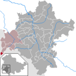
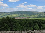
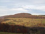
The Rhön Mountains (German: [ˈʁøːn] ) are a group of low mountains (or Mittelgebirge) in central Germany, located around the border area where the states of Hesse, Bavaria and Thuringia come together. These mountains, which are at the extreme southeast end of the East Hesse Highlands (Osthessisches Bergland), are partly a result of ancient volcanic activity. They are separated from the Vogelsberg Mountains by the river Fulda and its valley. The highest mountain in the Rhön is the Wasserkuppe (950.2 metres or 3,117 feet), which is in Hesse. The Rhön Mountains are a popular tourist destination and walking area.
Excerpt from the Wikipedia article Rhön Mountains (License: CC BY-SA 3.0, Authors, Images).Rhön Mountains
L 3476, Ehrenberg (Rhön)
Geographical coordinates (GPS) Address Nearby Places Show on map
Geographical coordinates (GPS)
| Latitude | Longitude |
|---|---|
| N 50.516551 ° | E 10.041391 ° |
Address
Dreiländereck Hessen-Bayern-Thüringen
L 3476
36115 Ehrenberg (Rhön)
Hesse, Germany
Open on Google Maps


