Laurensberg
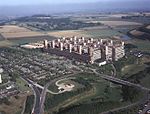
Laurensberg is a quarter (Stadtteil) and borough (Stadtbezirk) of Aachen, Germany. As a borough, Laurensberg includes, in addition to Laurensberg itself, Orsbach, Seffent, Soers, Vaalserquartier and Vetschau, as well as the residential areas of Gut Kullen and Steppenberg. Laurensberg is the largest district of Aachen by area. The borough borders other Aachen city boroughs Haaren, Aachen-Mitte and Richterich and the German communities of Kohlscheid (which is part of Herzogenrath) und Würselen (both of which belong to the district of Aachen, which is distinct from the city). Beyond the German border, the borough borders the Belgian town of Kelmis, in the Province of Liège, as well as the Dutch communities of Vaals, Gulpen-Wittem and Simpelveld, all contained with the Dutch Province of Limburg. The borough Laurensberg covers 2,997 hectares and has 20,381 inhabitants (as of 2020).The borough is characterized by its wide hilltop views and its interesting (from an art history perspective) St. Laurentius Catholic Church. A highlight of the old town center is the large park surrounding the Schloss Rahe, the former residence and water fortress of a patrician Aachen-area family, which was refashioned in the 18th century by the businessman Gerhard Heusch into a stately four-wing castle. Laurensberg is not to be confused with the former town of Laurenzberg, the remnants of which were absorbed by Eschweiler in the 1970s. Laurensberg is also home to the Rugby Club RC Aachen, a major competitor in the 2. Rugby-Bundesliga.
Excerpt from the Wikipedia article Laurensberg (License: CC BY-SA 3.0, Authors).Laurensberg
Roermonder Straße, Aachen Laurensberg
Geographical coordinates (GPS) Address Nearby Places Show on map
Geographical coordinates (GPS)
| Latitude | Longitude |
|---|---|
| N 50.797222222222 ° | E 6.0627777777778 ° |
Address
Roermonder Straße 325
52072 Aachen, Laurensberg
North Rhine-Westphalia, Germany
Open on Google Maps


