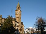
St Michael's Church of England High School, Chorley

St Michael's is a Church of England secondary school located in the town of Chorley, Lancashire, England. The school is home to 1,200 pupils, and is a performing Arts College. Since September 2016, the headteacher has been Jayne Jenks, who took over from Julie Heaton, who had occupied the post since January 2012. She started as a teacher of physical education in 1982. The school was established in 1964, as a Secondary Modern School. The first headteacher was Roy Moore. Educated at Lincoln College, Oxford he was an outlook, a Christian socialist, and a great believer in equality. A notable feature of the school, is that the houses and tutor groups are all named after people of notable Christian faith who have made significant personal, cultural, or religious contributions to society. The school became a comprehensive school in 1972, and an Academy in 2011. The school's uniform is a maroon blazer incorporating the school logo and motto. The lower school tie is maroon, with multiple silver crosses. The upper school tie is the same however with a black background. Hughes or the Chapel Choir (for Years 9 to 11) have a silver tie with maroon crosses. An optional jumper for lower school is maroon with a silver logo, the higher school jumper is black with a silver logo.
Excerpt from the Wikipedia article St Michael's Church of England High School, Chorley (License: CC BY-SA 3.0, Authors, Images).St Michael's Church of England High School, Chorley
Astley Road,
Geographical coordinates (GPS) Address Phone number Website External links Nearby Places Show on map
Geographical coordinates (GPS)
| Latitude | Longitude |
|---|---|
| N 53.6616 ° | E -2.6361 ° |
Address
St Michael's Church of England High School
Astley Road
PR7 1RS , Hartwood Green
England, United Kingdom
Open on Google Maps


