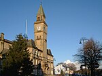
Chorley
ChorleyGeography of ChorleyMarket towns in LancashireTowns in LancashireUnparished areas in Lancashire ... and 1 more
West Pennine Moors

Chorley is a town and the administrative centre of the wider Borough of Chorley in Lancashire, England, 8.1 miles (13 km) north of Wigan, 10.8 miles (17 km) south west of Blackburn, 11 miles (18 km) north west of Bolton, 12 miles (19 km) south of Preston and 19.5 miles (31 km) north west of Manchester. The town's wealth came principally from the cotton industry. In the 1970s, the skyline was dominated by factory chimneys, but most have now been demolished: remnants of the industrial past include Morrisons chimney and other mill buildings, and the streets of terraced houses for mill workers. Chorley is the home of the Chorley cake.
Excerpt from the Wikipedia article Chorley (License: CC BY-SA 3.0, Authors, Images).Chorley
Am Markt,
Geographical coordinates (GPS) Address Nearby Places Show on map
Geographical coordinates (GPS)
| Latitude | Longitude |
|---|---|
| N 53.653 ° | E -2.632 ° |
Address
Rathauscenter
Am Markt
15517 , Mitte
Brandenburg, Deutschland
Open on Google Maps


