Cinderford
Civil parishes in GloucestershireForest of DeanTowns in GloucestershireTowns of the Welsh MarchesUse British English from August 2015

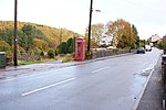
Cinderford is a town and civil parish on the eastern fringe of the Forest of Dean in Gloucestershire, England. The population was 8,777 at the 2021 Census.The town came into existence in the 19th century, following the rapid expansion of Cinderford Ironworks and the Forest of Dean Coalfield. Cinderford's origins can be seen in the style and layout of the town, with long rows of identical terraced housing similar to those found in the mining villages of the South Wales Valleys. The decline of the coal industry in the 1950s and 1960s affected Cinderford as most of the male population was employed in mining.
Excerpt from the Wikipedia article Cinderford (License: CC BY-SA 3.0, Authors, Images).Cinderford
Lamb Lane, Forest of Dean
Geographical coordinates (GPS) Address Nearby Places Show on map
Geographical coordinates (GPS)
| Latitude | Longitude |
|---|---|
| N 51.8225 ° | E -2.4989 ° |
Address
Lamb Lane
Lamb Lane
GL14 2RN Forest of Dean
England, United Kingdom
Open on Google Maps


