Slussenområdet

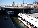
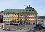
Slussenområdet (Swedish: [ˈslɵ̂sːɛnɔmˌroːdɛt], the Sluice area) is an area of central Stockholm, on the Söderström river, connecting Södermalm and Gamla stan. The area is named after the locks between Lake Mälaren and the Baltic Sea. Called Karl Johanslussen, the locks themselves allow passage between these two bodies of water (of different levels). Slussen also refers to the cloverleaf interchange and associated pedestrian passages and walkways opened on 15 October 1935. The Slussen metro station is a hub of public transport in Stockholm, serving the red and green lines of the Stockholm Metro, with an adjoining bus terminal and Saltsjöbanan commuter rail station serving the eastern parts of Stockholm and its surroundings. The Djurgården ferry departs adjacently.
Excerpt from the Wikipedia article Slussenområdet (License: CC BY-SA 3.0, Authors, Images).Slussenområdet
Stadsgårdsleden, Stockholm Södermalm (Södermalms stadsdelsområde)
Geographical coordinates (GPS) Address Nearby Places Show on map
Geographical coordinates (GPS)
| Latitude | Longitude |
|---|---|
| N 59.321111111111 ° | E 18.071944444444 ° |
Address
Stadsgårdsleden
Stadsgårdsleden
104 65 Stockholm, Södermalm (Södermalms stadsdelsområde)
Sweden
Open on Google Maps


