place

Green Mountain (Lakewood, Colorado)

Colorado geography stubsLandforms of Jefferson County, ColoradoMesas of ColoradoNorth American 2000 m summits
Green Mountain (Lakewood, Colorado)

Green Mountain is a mesa on the eastern flank of the Front Range of the Rocky Mountains of North America. The 6,854-foot (2,089 m) mesa summit is located in William Frederick Hayden Park in the City of Lakewood, Colorado, United States, 4.0 miles (6.5 km) west (bearing 265°) of the municipal center of Lakewood in Jefferson County.

Excerpt from the Wikipedia article Green Mountain (Lakewood, Colorado) (License: CC BY-SA 3.0, Authors, Images).

Green Mountain (Lakewood, Colorado)
Rooney Valley, Lakewood

Geographical coordinates (GPS) Address Nearby Places
placeShow on map

Wikipedia: Green Mountain (Lakewood, Colorado)Continue reading on Wikipedia

Geographical coordinates (GPS)

Latitude Longitude
N 39.7009482 ° E -105.1777065 °
placeShow on map

Address

Rooney Valley

Rooney Valley
80410 Lakewood
Colorado, United States
mapOpen on Google Maps

Green Mountain (Lakewood, Colorado)
Share experience

Nearby Places

Rooney Ranch
Rooney Ranch

Rooney Ranch is an historic ranch near Morrison, unincorporated Jefferson County, Colorado. Alexander Rooney came west in 1859 seeking an opportunity. He did a variety of work to earn his keep from stone masonry (Central City, the Masonic Lodge), cartage of lumber and other supplies to the mining camps around Denver and South Park, to a dairy farm. He found the high altitude uncomfortable, so he sought out winter pasture at lower elevations for his cattle. In the fall of 1861 he found what he was looking for along the eastern edge of the hogback, between the mountains and the plains. He brought his wife, Emeline, and his family west from Anamosa, Iowa.Over the years, he acquired many square miles of land. The family used homesteading to acquire 160 acres (65 hectares) for each qualified member of the family. They also purchased military patents, State land grant college lands, Union pacific lands, and property from other homesteaders. The ranch ran from the hogback on the west to the South Platte River on the east, from Bear Creek on the south to Table Mountain near Golden on the north. His main earnings were from the cattle and horses he raised. He introduced Galloway cattle from Scotland. Shipped from Scotland to Missouri, he drove them overland to his ranch. The Galloway cattle provided both meat and heavy coats from their hides. He also bred Morgan horses which were sold to the United States Cavalry and the British Army. The family discontinued the cattle ranching in 1971.

Dakota Hogback
Dakota Hogback

The Dakota Hogback is a long hogback ridge at the eastern fringe of the Rocky Mountains that extends north-south from southern Wyoming through Colorado and into northern New Mexico in the United States. The ridge is prominently visible as the first line of foothills along the edge of the Great Plains. It is generally faulted along its western side, and varies in height, with gaps in numerous locations where rivers exit the mountains. The ridge takes its name from the Dakota Formation, a formation with resistant sandstone beds that cap the ridge. The hogback was formed during the Laramide orogeny, approximately 50 million years (50 my) ago, when the modern Rockies were created. The general uplift to the west created long faulting in the North American Plate, resulting in the creation of the hogback.While the hogback was created during the Laramide Orogeny, the geologic strata comprising the hogback are much older. For example, fossilized data such as dinosaur footprints have been observed in the exposed strata, created by dinosaurs which lived during the Jurassic Period approximately 150 million years ago. Some of these footprints were attributed to the Diplodocus dinosaur and could be seen on the hogback west of Denver, Colorado as recently as the 1980s.The ridge forms a barrier between the high plains and the Rocky Mountain foothills. The ridge is pierced by a few water-cut gaps, which have been used to provide road access between the mountains and the plains. The ridge is paralleled by I-25 from north of Cheyenne, Wyoming, through Colorado, into northern New Mexico. The ridge is to the west. North of Denver its major gaps are I-80 in southern Wyoming, U.S. Highway 34 at Loveland, and U.S. 36 to Rocky Mountain National Park. Interstate 70 passes through a highway cut, revealing the numerous layers making up the ridge. South of Denver, the major gaps are U.S. Route 24 in Colorado Springs, U.S. Route 50 in Pueblo, and finally in Colorado, U.S. Route 160 in Walsenburg.

Dinosaur Ridge
Dinosaur Ridge

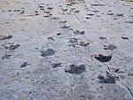
Dinosaur Ridge is a segment of the Dakota Hogback in the Morrison Fossil Area National Natural Landmark located in Jefferson County, Colorado, near the town of Morrison and just west of Denver. The Dinosaur Ridge area is one of the world's most famous dinosaur fossil localities. In 1877, fossil excavation began at Dinosaur Ridge under the direction of paleontologist Othniel Charles Marsh. Some of the best-known dinosaurs were found here, including Stegosaurus, Apatosaurus, Diplodocus, and Allosaurus. In 1973, the area was recognized for its uniqueness as well as its historical and scientific significance when it was designated the Morrison Fossil Area National Natural Landmark by the National Park Service. In 1989, the Friends of Dinosaur Ridge formed to address increasing concerns regarding the preservation of the site and to offer educational programs on the area's resources. The rocks on the west side of Dinosaur Ridge are part of the widespread Morrison Formation of Jurassic age. It is in these rocks, where Arthur Lakes discovered the dinosaur bones in 1877. Fifteen quarries were opened along the Dakota hogback in the Morrison area in search of these fossils. The rocks on the east side of Dinosaur Ridge are part of the Cretaceous Dakota Formation. When Alameda Parkway was being constructed in 1937 to provide access to Red Rocks Park, workers discovered hundreds of dinosaur footprints. These were found to include mostly Iguanodon-like footprints, perhaps from Eolambia. Carnivorous theropod tracks are also present. The site features the Dinosaur Ridge Exhibit Hall with displays about the dinosaurs found at the site. Additionally, Dinosaur Ridge has interpretive signs at trail locations that explain the local geology, a volcanic ash bed, trace fossils, paleo-ecology, economic development of coal, oil and clay, and many other geologic and paleontological features. In June 2011, Dinosaur Ridge was combined with another track site, the Parfet Prehistoric Preserve, about three miles north. The combined National Natural Landmark is now the Morrisson-Golden Fossil Areas.

Mount Vernon, Colorado

Mount Vernon is an extinct town from the former Jefferson Territory, the site of which is located in present-day Jefferson County, Colorado. Mount Vernon was founded in 1859 by Dr. Joseph Casto who followed the gold rush to Colorado in 1858. He did not find gold, but decided to establish a town between the mining camps and the city of Denver. With three other men, he founded the Denver, Auraria, and Colorado Wagon Company in December 1859. After gold ore was discovered near Central City in 1859, a trail was established through Mount Vernon. It was a main route into the mountain. A toll road that passed through Mount Vernon and through Mount Vernon Canyon was built by the wagon company, and then purchased in 1880 by Jefferson County and no longer requiring a toll to use the road. The road became U.S. 40, and then Interstate 70.At its height, there were about 200 people who lived in the town, but by 1885 it only had 50 residents. One of the town's citizens was Robert Williamson Steele, the governor of Jefferson Territory, who often worked out of his Mount Vernon house. The town had its own post office, two hotels, homes, and a store. It was described as a "beautiful and romantic village... [with] a number of neat and tidy houses." The town had a gypsum deposit and it had limestone and lime kilns. The town was abandoned over time.Its cemetery, which still exists on the Village Trail within the Jefferson County Open Space. With a grave stone dated 1860, it is one of the oldest cemeteries in the state.