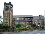
Milnrow is a town within the Metropolitan Borough of Rochdale, in Greater Manchester, England. It lies on the River Beal at the foothills of the South Pennines, and forms a continuous urban area with Rochdale. It is 2 miles (3.2 km) east of Rochdale town centre, 10 miles (16.1 km) north-northeast of Manchester, and spans from Windy Hill in the east to the Rochdale Canal in the west. Milnrow is adjacent to junction 21 of the M62 motorway, and includes the village of Newhey, and hamlets at Tunshill and Ogden.
Historically in Lancashire, Milnrow during the Middle Ages was one of several hamlets in the township of Butterworth and parish of Rochdale. The settlement was named by the Anglo-Saxons, but the Norman conquest of England resulted in its ownership by minor Norman families, such as the Schofields and Cleggs. In the 15th century, their descendants successfully agitated for a chapel of ease by the banks of the River Beal, triggering its development as the main settlement in Butterworth. Milnrow was primarily used for marginal hill farming during the Middle Ages, and its population did not increase much until the dawn of the woollen trade in the 17th century.
With the development of packhorse routes to emerging woollen markets in Yorkshire, the inhabitants of Milnrow adopted the domestic system, supplementing their income by fellmongering and producing flannel in their weavers' cottages. Coal mining and metalworking also flourished in the Early Modern period, and the farmers, colliers and weavers formed a "close-knit population of independent-minded workers". The hamlets of Butterworth coalesced around the commercial and ecclesiastical centre in Milnrow as demand for the area's flannel grew. In the 19th century, the Industrial Revolution supplanted domestic woollen industries and converted the area into a mill town, with cotton spinning as the principal industry. Mass-produced textile goods from Milnrow's cotton mills were exported globally with the arrival of the railway in 1863. The Milnrow Urban District was established in 1894 and was governed by the district council until its abolition in 1974.
Deindustrialisation and suburbanisation occurred throughout the 20th century resulting in the loss of coal mining and cotton spinning. Milnrow was merged in to the Metropolitan Borough of Rochdale in 1974, and has since become suburban to Rochdale. However, the area has retained "a distinct and separate character", and has been described as "the centre of the south Lancashire dialect". John Collier (who wrote under the pseudonym of Tim Bobbin) is acclaimed as an 18th-century caricaturist and satirical poet who produced Lancashire-dialect works during his time as Milnrow's schoolmaster. Rochdale-born poet Edwin Waugh was influenced by Collier's work, and wrote an extensive account of Milnrow during the mid-19th century in a tribute to him. Milnrow has continued to grow in the 21st century, spurred by its connectivity to road, rail and motorway networks. Surviving weavers' cottages are among Milnrow's listed buildings, while the Ellenroad Steam Museum operates as an industrial heritage centre.


