place

Monkleigh

Civil parishes in DevonTorridge DistrictUse British English from July 2016Villages in Devon
Monkleigh across the fields geograph.org.uk 667182

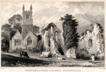
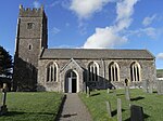
Monkleigh is a village, parish and former manor in north Devon, England, situated 2 1/2 miles north-west of Great Torrington and 3 1/2 miles south-east of Bideford. An electoral ward exists titled Monkleigh and Littleham. The population at the 2011 census was 1,488.

Excerpt from the Wikipedia article Monkleigh (License: CC BY-SA 3.0, Authors, Images).

Monkleigh
Hilton Road, Torridge District Monkleigh

Geographical coordinates (GPS) Address Nearby Places
placeShow on map

Wikipedia: MonkleighContinue reading on Wikipedia

Geographical coordinates (GPS)

Latitude Longitude
N 50.9626 ° E -4.20036 °
placeShow on map

Address

Hilton Road

Hilton Road
EX39 5JU Torridge District, Monkleigh
England, United Kingdom
mapOpen on Google Maps

Monkleigh across the fields geograph.org.uk 667182
Share experience

Nearby Places

Beam, Great Torrington

Beam is an historic estate in the parish of Great Torrington, Devon, England. Beam House is situated about 1 1/2 miles north-west and downstream of that town, on the right-bank of the River Torridge. Both the Rolle Canal and the railway crossed the river nearby. It occupies a particularly beautiful setting, described by Lauder (1986) thus: "For lovers of rivers and woodland there can be few lovlier settings for a house than this. Steeply wooded banks shelter the valley and the house is situated on slightly higher ground above lush water meadows, almost completely surrounded by the Torridge" The estate was a subsidiary seat of the Rolle family, lords of the manor of Great Torrington, whose main seat was Stevenstone on the other (south) side of that town and therefore upstream from Beam. It was an outpost of the Royalists during the Civil War. Much of the estate is today owned by Baron Clinton, as heir to the Rolles, but it has had many occupants, including use by the army in both world wars and as a borstal. Tarka the Otter was born at Beam, by what the author Henry Williamson called the "Canal Bridge" (i.e. the Beam Aqueduct) and particularly favoured the River Torridge at Beam Weir. Thus the cycleway which crosses the river at Beam, formerly the railway line, was named the "Tarka Trail", due to its association with these and other haunts of the fictional animal. Today Beam is used as an adventure centre for young people.