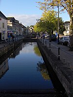
Radstock is a town and civil parish on the northern slope of the Mendip Hills in Somerset, England, about 9 miles (14 km) south-west of Bath and 8 miles (13 km) north-west of Frome. It is within the area of the unitary authority of Bath and North East Somerset. The Radstock built-up area had a population of 9,419 at the 2011 Census.
Radstock has been settled since the Iron Age, and its importance grew after the construction of the Fosse Way, a Roman road. The town grew after 1763, when coal was discovered in the area. Large numbers of mines opened during the 19th century, including several owned by the Waldegrave family, who had been Lords of the Manor since the Civil War. Admiral Lord Radstock, brother of George, fourth Earl Waldegrave, took the town's name as his title when created a Baron.
The spoil heap of Writhlington colliery is now the Writhlington Site of Special Scientific Interest, which includes 3,000 tons of Upper Carboniferous spoil from which more than 1,400 insect fossil specimens have been recovered. The complex geology and narrow seams made coal extraction difficult. Tonnage increased throughout the 19th century, reaching a peak around 1901, when there were 79 separate collieries and annual production was 1,250,000 tons per annum. However, due to local geological difficulties and manpower shortages, output declined and the number of pits reduced from 30 at the beginning of the 20th century to 14 by the mid-thirties; the last two pits, Kilmersdon and Writhlington, closed in September 1973. Manufacturing industries such as printing, binding and packaging provide some local employment. In recent years, Radstock has increasingly become a commuter town for the cities of Bath and Bristol.
Radstock is home to the Radstock Museum which is housed in a former market hall, and has a range of exhibits which offer an insight into north-east Somerset life since the 19th century. Many of the exhibits relate to local geology and the now disused Somerset coalfield. The town is also home to Writhlington School, famous for its Orchid collection, and a range of educational, religious and cultural buildings and sporting clubs.


