South Santa Clara Valley, California
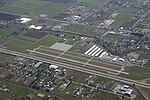
South Santa Clara Valley is a census county division (CCD) located in south Santa Clara County, California. The area covers approximately 118 square miles (310 km2), and includes the cities of Morgan Hill, San Martin, and Gilroy as well as their immediate outlying unincorporated areas. The area is bounded by Coyote to the north, Llagas-Uvas to the west, Diablo Range to the east, and San Benito County to the south. As of the 2010 US Census, the population was 103,477 residents of whom 47.0% were Hispanic, 40.8% non-Hispanic white, 7.6% Asian, and 4.6% of other races, with a median age of 40.5 years old.Most residents and businesses in the area use postal zip codes from neighboring cities of Morgan Hill, San Martin, and Gilroy. The telephone area code is 408.
Excerpt from the Wikipedia article South Santa Clara Valley, California (License: CC BY-SA 3.0, Authors).South Santa Clara Valley, California
Rucker Avenue,
Geographical coordinates (GPS) Address Nearby Places Show on map
Geographical coordinates (GPS)
| Latitude | Longitude |
|---|---|
| N 37.054722222222 ° | E -121.57777777778 ° |
Address
Rucker Avenue 730
95020
California, United States
Open on Google Maps


