place

Yenikapı railway station

1872 establishments in the Ottoman Empire2013 disestablishments in TurkeyRailway stations closed in 2013Railway stations in Istanbul ProvinceRailway stations opened in 1872
Turkish railway station stubs
Yenikapi railway station

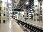
Yenikapı is an indefinitely closed railway station on the İstanbul-Halkalı Line in the Yenikapı neighborhood of Istanbul, Turkey. The station was built in 1872 by the Oriental Railway which was then taken over by the Turkish State Railways in 1937 and electrified in 1955. The station is situated near the south end of the busy Gazi Mustafa Kemal Paşa Boulevard and one block north of Kennedy St, two major inner-city roadways and is 4.8 km (3.0 mi) west of Sirkeci Terminal. Due to the rehabilitation of the line between Halkalı and Kazlıçeşme for future Marmaray commuter service, Yenikapı was indefinitely closed on 19 March 2013. On 29 October 2013, the new underground Yenikapı railway station, which makes up a part of the new Yenikapı Transfer Center, was opened along with the trans-Bosphorus Marmaray tunnel. The new Yenikapı complex is located right next to the existing railway station and is serviced by 3 lines of the Istanbul Metro.

Excerpt from the Wikipedia article Yenikapı railway station (License: CC BY-SA 3.0, Authors, Images).

Yenikapı railway station
Alboyacılar Sokağı, Istanbul

Geographical coordinates (GPS) Address Nearby Places
placeShow on map

Wikipedia: Yenikapı railway stationContinue reading on Wikipedia

Geographical coordinates (GPS)

Latitude Longitude
N 41.004722222222 ° E 28.9525 °
placeShow on map

Address

Yenikapı

Alboyacılar Sokağı
34096 Istanbul
Türkiye
mapOpen on Google Maps

Yenikapi railway station
Share experience

Nearby Places

Harbour of Eleutherios

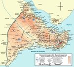
The Harbour of Eleutherios (Medieval Greek: λιμήν Ἐλευθερίου), originally known as the Harbour of Theodosius (Latin: Portus Theodosiacus, Ancient Greek: λιμήν Θεοδοσίου) was one of the ports of ancient Constantinople, the capital of the Byzantine Empire, located beneath the modern Yenikapi neighbourhood of Istanbul, Turkey. It was built at the mouth of the Lycus watercourse that ran through the city to the Propontis (the Sea of Marmara).The harbour was built in the late 4th century, during the reign of Theodosius I, and was the city's major point of trade in Late Antiquity. It continued to be used until the 11th century. Silt from the Lycus creek eventually filled the harbour entirely and the area was later transformed for agricultural use due to the effects of upstream erosion and deposition. In Ottoman times, the area was built over. The harbour was located on the south side of the peninsula on which the city is built, on the shore of the Sea of Marmara. The other harbours on the southern coast of the city were the Harbour of Julian and the small harbour of the Boukoleon Palace. The harbours of Neorion (Latin: Neorium) and Prosphorion (Ancient Greek: προσφόριον, lit. 'import harbour', Latin: Portus Prosphorianus) were on the Golden Horn, on the northern shore of the peninsula. Today the northern coast of the harbour is delineated by Kucuk Langa Cad. (Small Langa St.) named after the earlier Greek Vlanga name. In November 2005, workers on the Bosphorus Tunnel Project discovered the silted-up remains of the harbour. Excavations produced evidence of the 4th-century Portus Theodosiacus. There, archaeologists uncovered traces of the city wall of Constantine the Great, and the remains of over 35 Byzantine ships from the 7th to 10th centuries, including several Byzantine galleys, remains of which had never before been found. In addition, the excavation has uncovered the oldest evidence of settlement in Constantinople, with artefacts, including amphorae, pottery fragments, shells, pieces of bone, horse skulls, and nine human skulls found in a bag, dating back to 6000 BC.

Laleli, Fatih
Laleli, Fatih

Laleli (meaning 'with tulips' in Turkish) is a neighbourhood of Fatih, Istanbul, Turkey, lying between Beyazıt and Aksaray. It is known for its large textile wholesaling business and is home to the Literature and Science Faculties of Istanbul University, designed by Sedad Hakkı Eldem and Emin Onat in the 1940s. It is served by a stop on the T1 tram line which runs along Ordu Caddesi. The most prominent historic monument in Laleli is the Laleli Mosque, a work of architect Mehmed Tahir Ağa that was originally constructed in the 1760s. It was built for Sultan Mustafa III whose tomb it contains. An attractive sebil or water dispensary stands on the street side of the complex surrounding the mosque. The mosque stands above a large basement that is now filled with clothes shops. Across the road from the mosque is the Koca Ragıp Paşa complex, also designed by Mehmed Tahir Ağa in 1762. It was undergoing restoration for much of the 2010s. Lurking in the back streets is the much older Bodrum Mosque (AKA Mesih Paşa Cami), which started life as a 10th-century Byzantine church attached to the Myreiaion Palace. Beside it is an underground cistern, probably of similar date. Both stand on the site of a lost Rotunda dating back to the fifth century which is believed to have been the second largest such circular Roman temple after the Pantheon in Rome itself. Also in Laleli is the Big Stone Han (Büyük Taş Hanı in Turkish) which was probably part of the Laleli Mosque complex and contains the remains of another cistern. Now a hotel, the Tayyare (Harikzedegen) apartment block, was the first building made from reinforced concrete in Constantinople. It was designed by architect Kemaleddin Bey to house those displaced by a fire in Fatih in 1918.