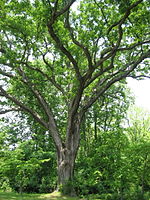
Bethesda Trolley Trail
Bethesda, MarylandMontgomery County, Maryland geography stubsProtected areas of Montgomery County, MarylandRail trails in MarylandTransportation in Montgomery County, Maryland

The Bethesda Trolley Trail, at one time known as the North Bethesda Trail, is a 5.9-mile (9.5 km) long rail trail from Bouic Avenue next to the Twinbrook Metro Station in the city of Rockville to Battery Lane Park in Bethesda, Maryland.
Excerpt from the Wikipedia article Bethesda Trolley Trail (License: CC BY-SA 3.0, Authors, Images).Bethesda Trolley Trail
Bethesda Trolley Trail, Bethesda Pooks Hill
Geographical coordinates (GPS) Address Nearby Places Show on map
Geographical coordinates (GPS)
| Latitude | Longitude |
|---|---|
| N 39.015555555556 ° | E -77.111944444444 ° |
Address
Bethesda Trolley Trail
Bethesda Trolley Trail
20891 Bethesda, Pooks Hill
Maryland, United States
Open on Google Maps


