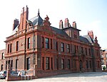
Tanhouse Lane railway station
Tanhouse Lane railway station is a closed station on the former Sheffield and Midland Railway Companies' Committee line, which formed a loop off the Cheshire Lines Committee (CLC) line in the Widnes area between Liverpool Central and Manchester Central. It was opened on 1 September 1890 as "Tanhouse", being changed later to "Tanhouse Lane". It closed on 5 October 1964.In 1922 13 "Down" (towards Liverpool) trains called on "Week Days" (Mondays to Saturdays). Eight ran from Warrington Central, two from Manchester Central and two started at Tanhouse Lane itself, all headed for Liverpool Central. One ran from Tanhouse Lane to Garston and there was the 12:15 from London Marylebone to Liverpool Central which called at Tanhouse Lane at 18:59. "Up" services were similar.The station was situated in an industrial area and was popular with workers travelling to and from it. With the rise in the use of the motor car, the station was nominated for closure in the Beeching Report. The final services ran on 3 October 1964, with the first service of the morning to terminate at Tanhouse Lane being a workmen's train; and the station closed from 5 October 1964. The goods yard remained in use until the late 1990s to serve the Blue Circle cement facility on Tanhouse Lane. The area fell into dereliction until a short section of the former Widnes Loop was converted into a heritage feature. A short section of a wall from the station can still be seen.
Excerpt from the Wikipedia article Tanhouse Lane railway station (License: CC BY-SA 3.0, Authors).Tanhouse Lane railway station
Moss Bank Road,
Geographical coordinates (GPS) Address Nearby Places Show on map
Geographical coordinates (GPS)
| Latitude | Longitude |
|---|---|
| N 53.362777777778 ° | E -2.7113888888889 ° |
Address
Moss Bank Road
Moss Bank Road
WA8 0RU , Moss Bank
England, United Kingdom
Open on Google Maps


