Electoral district of Sandhurst

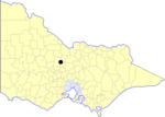
Sandhurst (initially Sandhurst Boroughs) was an electoral district of the Legislative Assembly in the Australian state of Victoria from 1856 to 1904. It was based on the towns of Sandhurst (now Bendigo) and Lockwood. The district was defined as: SANDHURST — Commencing at a point on the Bendigo Creek 40 chains south of the junction of Ash-street and High-street; thence east one mile and a half; thence north four miles; thence west two and a half miles, crossing the Bendigo Creek, thence south four miles, thence east to the point of commencement. LOCKWOOD — Commencing at the south-western angle of suburban allotment 23, section 1; bounded on the east by a line northward from that point to the southeastern angle of portion 44, section 4; on the north by a line bearing west to the south-western angle of allotment No. 1, section 4, on the west by a line bearing south to a point due west from the commencing point; and on the south by a line east to the south-west angle of suburban allotment No. 23, section 1, being the commencing point. aforesaid. From 1904, Sandhurst was split into two districts, Bendigo West and Bendigo East.The district of Sandhurst Boroughs was one of the initial districts of the first Victorian Legislative Assembly, 1856.
Excerpt from the Wikipedia article Electoral district of Sandhurst (License: CC BY-SA 3.0, Authors, Images).Electoral district of Sandhurst
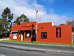
Bannerman Street, Bendigo
Geographical coordinates (GPS) Address Nearby Places Show on map
Geographical coordinates (GPS)
| Latitude | Longitude |
|---|---|
| N -36.75 ° | E 144.26666666667 ° |
Address
Bannerman Street
Bannerman Street
3550 Bendigo (Bendigo)
Victoria, Australia
Open on Google Maps


