Lahn

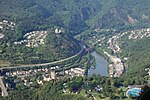
The Lahn is a 245.6-kilometre-long (152.6 mi), right (or eastern) tributary of the Rhine in Germany. Its course passes through the federal states of North Rhine-Westphalia (23.0 km), Hesse (165.6 km), and Rhineland-Palatinate (57.0 km). It has its source in the Rothaargebirge, the highest part of the Sauerland. It meets the Rhine at Lahnstein, near Koblenz. Important cities along the Lahn include Marburg, Gießen, Wetzlar, Limburg an der Lahn, Weilburg and Bad Ems. Tributaries to the Lahn include the Ohm, Dill, the Weil and the Aar. The lower Lahn has many dams with locks, allowing regular shipping from its mouth up to Runkel. Riverboats also operate on a small section north of the dam in Gießen.
Excerpt from the Wikipedia article Lahn (License: CC BY-SA 3.0, Authors, Images).Lahn
Damianweg,
Geographical coordinates (GPS) Address Nearby Places Show on map
Geographical coordinates (GPS)
| Latitude | Longitude |
|---|---|
| N 50.308888888889 ° | E 7.595 ° |
Address
Damianweg
56112 , Niederlahnstein
Rhineland-Palatinate, Germany
Open on Google Maps


