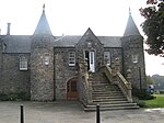
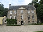
place

Inverury and Old Meldrum Junction Railway

1855 establishments in ScotlandClosed railway lines in ScotlandEarly Scottish railway companiesGreat North of Scotland RailwayPages with no open date in Infobox station
Railway companies disestablished in 1866Railway companies established in 1855Railway lines opened in 1856Standard gauge railways in Scotland

The Inverury and Old Meldrum Junction Railway was a railway company in Aberdeenshire, Scotland, that opened a short branch line between the places in its name. (The spelling has been changed over the years.) It was built by local people to revive the fortunes of a market town that had declined, and it opened in 1856. The railway was a commercial failure, and it was soon leased to the larger Great North of Scotland Railway (GNoSR), and it was absorbed by the GNoSR in 1866. Road vehicle competition worsened the railway's already weak position and in 1931 the passenger service was discontinued. In 1966 the branch line was completely closed down.

Excerpt from the Wikipedia article Inverury and Old Meldrum Junction Railway (License: CC BY-SA 3.0, Authors).

Inverury and Old Meldrum Junction Railway
Westend Gardens,

Geographical coordinates (GPS) Address Nearby Places
placeShow on map

Wikipedia: Inverury and Old Meldrum Junction RailwayContinue reading on Wikipedia

Geographical coordinates (GPS)

Latitude Longitude
N 57.334 ° E -2.328 °
placeShow on map

Address

Old Meldrum

Westend Gardens
AB51 0JG
Scotland, United Kingdom
mapOpen on Google Maps

Share experience

Nearby Places

Kirkton of Bourtie stone circle

Kirkton of Bourtie stone circle is a recumbent stone circle located in Aberdeenshire, Scotland. It is situated about 2+3⁄4 miles (4.4 km) to the northeast of Inverurie at the end of a south-facing hillside just outside the hamlet of Kirkton of Bourtie. It stands on arable land near a minor road at an altitude of 515 ft (157 m) above sea level, with the Hill of Barra prominently visible to the north.The circle is badly damaged, with only the eastern flanker, the recumbent and two western stones surviving. The recumbent is broken but is the longest of all known such stones; it measures around 17 ft (5.2 m) in length by 3 ft 4 in (1.02 m) broad and with a girth of 6 ft 4 in (1.93 m). It probably weighs upwards of thirty tons. The stone sits on a slightly raised mound and is aligned with the "major southern moonset". The east stone is 9 ft 10 in (3.00 m) high, while the west stones are 6 ft (1.8 m) and 7 ft 9 in (2.36 m) high. The other stones, of which there were once probably six or seven, are missing, but it is thought that the circle may originally have had a diameter of around 71 ft (22 m). Some stones that may possibly be from the circle have been incorporated in a nearby gateway and wall. Fragmentary cairns are visible within the ring.The area around the stones appears to have been used as a dump for naturally deposited stones that have been cleared off the fields. A "rude pavement" in the circle that was described in 1867 has by now disappeared entirely. This may have been the base of a now-destroyed cairn. The circle's partial destruction may well have occurred in fairly recent history. Writing in the late 18th century, the Rev Thomas Shepherd referred to the presence in the area of "three Druidical circles here, two of them pretty entire". Half a century later, only two of those remained, namely Kirkton of Bourtie and Sheldon stone circle, the latter of which was said to be in "a state of considerable preservation". By the time it was mapped by the Ordnance Survey in 1867 the Kirkton of Bourtie circle had been reduced to its present four stones; the map-makers reported, "No one [in] the parish remembers having seen it in any other condition than at present." The circle was scheduled by the Office of Works as an ancient monument in 1925, but its interior remained under the plough until as late as 1999.