place

River Eau

Rivers of LincolnshireTrent catchmentTributaries of the River TrentUse British English from September 2017
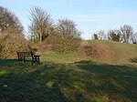
The River Eau, Scotter geograph.org.uk 970226

The River Eau ( YOO) is a 15-mile-long (24 km) tributary of the River Trent that flows through Lincolnshire, England.The Eau catchment lies between that of the Bottesford Beck to the north, and the River Witham to the south and east, and covers an area of 125 square kilometres (48 square miles). The river is one of the few notable streams that drain the right bank of the tidal Trent.The source of the river is near Harpswell, at the foot of the Lincolnshire Edge, and it joins the tidal River Trent at Susworth. Unlike other rivers that drain into the tidal Trent, there is no pumping station associated with the outfall, it relies on gravity to discharge during periods of tidal low water.The Eau flows through the village of Scotter, which has a history of being flooded by the river; the most recent occasion was in June 2007.The river is also important for the drainage of the flat low-lying agricultural land that surrounds it, with some 2000 hectares or 20 square kilometres (8 square miles) of the Gainsborough Internal Drainage Board district, relying on the Eau for this function. Whilst the drains that discharge into the Eau are maintained by the Drainage Board, the river is the responsibility of the Environment Agency being designated as a Main river.Its tributaries are Northorpe Beck, Manton Sewer and Dar Beck.

Excerpt from the Wikipedia article River Eau (License: CC BY-SA 3.0, Authors, Images).

River Eau
West Lindsey

Geographical coordinates (GPS) Address Nearby Places
placeShow on map

Wikipedia: River EauContinue reading on Wikipedia

Geographical coordinates (GPS)

Latitude Longitude
N 53.519612 ° E -0.738527 °
placeShow on map

Address


DN17 3AW West Lindsey
England, United Kingdom
mapOpen on Google Maps

The River Eau, Scotter geograph.org.uk 970226
Share experience

Nearby Places

Susworth
Susworth

Susworth is a hamlet in the West Lindsey district of Lincolnshire, England. It is on the east bank of the River Trent, 3 miles (5 km) west from Scotter, in which civil parish it lies. The nearest large towns are Gainsborough, approximately 7 miles (11 km) to the south, and Scunthorpe 7 miles to the north-east. This settlement documented as 'Susworth' was recorded c.1200, parts of which were considered associated with East Ferry.In the second half of the 18th century, before the establishment of the Methodist chapel, invited Wesleyan preachers, one of whom was John Wesley, used a private house in the hamlet.Susworth is recorded in the 1872 White's Directory as a hamlet of Scotter, others being Scotterthorpe and Cotehouses. There were six farmers in the hamlet, one of whom was also a blacksmith. There was the licensed victualler of the White Horse public house who was also a coal merchant, a further coal merchant, two shopkeepers, a joiner & wheelwright, a corn miller, a maltster, and a foreman maltster.In 1885 Susworth contained a Primitive Methodist chapel. Occupations included ten farmers, a shopkeeper, wheelwright, blacksmith, and the landlord of the White Horse public house. By 1933 there were two Methodist chapels and a church reading room. The number of farmers had dropped to five, with one smallholder. A shop and the White Horse pub still existed.Susworth soldiers killed in the First World War received no memorial within the village; at least eleven Susworth men survived the war.The village contains a centre for civil marriages run by North Lincolnshire Council, a riverside inn and a post box.