place

2013 Hattiesburg tornado

2013 in Mississippi2013 natural disasters in the United StatesF4 tornadoes by dateF4 tornadoes by locationFebruary 2013 events in the United States
Hattiesburg, MississippiTornadoes in MississippiTornadoes of 2013Use mdy dates from February 2013
Hattiesburg radar feb 10 2013

On Sunday, February 10, 2013, a large EF4 multiple-vortex wedge tornado devastated the cities of West Hattiesburg, Hattiesburg, and Petal, Mississippi. The tornado was one of eight that touched down in southern Mississippi and southwestern Alabama that day. It reached a maximum path width of 0.75 miles (1.21 km) in its path through the Hattiesburg area and reached estimated maximum sustained winds of 170 mph (270 km/h) in Oak Grove neighborhood of West Hattiesburg. It destroyed many structures and impacted University of Southern Mississippi and two high schools (Oak Grove High School and Hattiesburg High School). Mississippi was declared a federal disaster area by President Barack Obama, and a state of emergency was issued by Mississippi Governor Phil Bryant.

Excerpt from the Wikipedia article 2013 Hattiesburg tornado (License: CC BY-SA 3.0, Authors, Images).

2013 Hattiesburg tornado
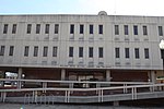
North 20th Avenue, Hattiesburg

Geographical coordinates (GPS) Address Nearby Places
placeShow on map

Wikipedia: 2013 Hattiesburg tornadoContinue reading on Wikipedia

Geographical coordinates (GPS)

Latitude Longitude
N 31.33 ° E -89.321 °
placeShow on map

Address

North 20th Avenue 321
39401 Hattiesburg
Mississippi, United States
mapOpen on Google Maps

Hattiesburg radar feb 10 2013
Share experience

Nearby Places

Hattiesburg, Mississippi

Hattiesburg is the 5th most populous city in the U.S. state of Mississippi, located primarily in Forrest County (where it is the county seat and most populous city) and extending west into Lamar County. The city population was 45,989 at the 2010 census, with the population now being 48,730 in 2020. Hattiesburg is the principal city of the Hattiesburg Metropolitan Statistical Area, which encompasses Covington, Forrest, Lamar, and Perry counties. The city is located in the Pine Belt region. Development of the interior of Mississippi took place primarily after the American Civil War. Before that time, only properties along the major rivers were developed as plantations. Founded in 1882 by civil engineer William H. Hardy, Hattiesburg was named in honor of Hardy's wife Hattie. The town was incorporated two years later with a population of 400. Hattiesburg's population first expanded as a center of the lumber and railroad industries, from which was derived the nickname "The Hub City". It now attracts newcomers because of the diversity of its economy, strong neighborhoods, and the central location in South Mississippi. Hattiesburg is a prominent college town, home to the University of Southern Mississippi (founded as Mississippi Normal College, for the training of teachers) and William Carey University (formerly William Carey College). South of Hattiesburg is Camp Shelby, the largest US National Guard training base east of the Mississippi River, which hosts up to 100,000 National Guardsmen and Reservists annually.