place

Palakkad Fort

1766 establishments in IndiaArchaeological sites in KeralaBuildings and structures in Palakkad districtForts in KeralaMysorean invasion of Malabar
Palakkad
Palakkad Tipu Fort
Palakkad Tipu Fort

Palakkad Fort is an old fort situated in the heart of Palakkad city of Kerala state, southern India. It was recaptured and rebuilt grandly by Sultan Hyder Ali in 1766 A.D and remains one of the best-preserved forts in Kerala.

Excerpt from the Wikipedia article Palakkad Fort (License: CC BY-SA 3.0, Authors, Images).

Palakkad Fort
Palakkad Kunnathurmedu

Geographical coordinates (GPS) Address Nearby Places
placeShow on map

Wikipedia: Palakkad FortContinue reading on Wikipedia

Geographical coordinates (GPS)

Latitude Longitude
N 10.7676 ° E 76.6614 °
placeShow on map

Address


678001 Palakkad, Kunnathurmedu
Kerala, India
mapOpen on Google Maps

Palakkad Tipu Fort
Palakkad Tipu Fort
Share experience

Nearby Places

Manapullikavu
Manapullikavu

Manapullikavu is a Hindu temple located in Palakkad city, Kerala of India. The temple is most famous for the annual festival that takes place in the temple known as Manappullikavu Vela. Manapullikavu is also a major residential area in Palakkad city comprising apartments and residential colonies. Manappulikavu is ward 27 of Palakkad Municipality.Sree Manappully Bhagavathy Temple is situated in Palakkad city, Kerala . It is on the Palakkad–Chittur road and hardly 200 meters away from the National Highway 544 .Earlier the temple was under the private ownership of ‘Kenath Family’. Now the temple is under Malabar Devaswom Board (MDB). Kariyannur Manakkal Bavathrathan Namboothiripad of Pattambi is the Thanthri (Head Priest) of the temple now. Sri Manappully Bhagavathy Temple has a very ancient history. It is believed that the temple originally belonged to Sri Mattappilly Bhadrakali Mana, a famous Kerala Brahmin family of Kerala. Numerous Bhrahmin families living on the banks of Holi River Sokanasini (Bharathapuzha) used to perform ‘Yagas’ on the river bed. Thus the area came to be known as ‘Yaga-kara’ which later came to be known as ‘Yakkara’. The eastern part of Yakkara where the temple is located, is called East Yakkara and the other side as ‘West Yakkara’. It is believed that the ‘Moolasthanam’ of Bhagavathy was at West Yakkara and it was subsequently shifted to the present Sanctum Santorum of the East Yakkara temple. (It is believed that a saintly Brahmin of Yagakkara conducted his prayers in his kitchen which is also called as ‘madappalli’. It is considered that in the course of time and usage, the area came to be known as "Manappulli"). Sree Manappulli Bhagavathi is Bhadrakaali and was born out of the sacred "Jada" of Lord Shiva during Dakshayaga. She is black in colour, with four hands, each one having Soolam, Kapalam, Gadkam and Khedam. She is with three eyes, two ‘Dhamshtram’, with ‘Pattudayada’ and valuable ornaments. The Prathishta is in ‘Shanta Bhava’. During ‘Chandattam’ ceremony She turns to ‘Rudra Bhava’ and becomes ‘Shanta Swaroopini ‘after accepting the ‘Kadummadura Payasa Nivedyam’. She is believed to satisfy the desires, hopes and aspirations of her true devotees and also protect them from all evils. According to a legendary myth about the temple, an Asura called Neelan was disturbing the people with his misdeeds and became a menace to them. The people, complained about this to Parasuraman and he in turn sought a remedy from Lord Paramasiva. Paramasiva incarnating his female personality to Bhadra Kali and sent her to Akamalavaram to kill Neelan. After killing Neelan, Kali became Manappulli Bhagavathy showering prosperity to her devotees. The Palghat district where the temple is situated, has mainly paddy cultivation as the main occupation of the people. The district is called the ‘Rice Bowl’ of Kerala. The social and cultural customs of the people are, therefore, one way or other, connected with paddy cultivation. They believe that the Goddesses of ‘Kavu’ (temple) protect them in their ‘Thattakam’ (meaning the area where they live, surrounds the ‘Kavu’). The people make offerings to the Goddesses in their ‘Thattakam’ in the form agricultural produces having bearing on the seasonal agriculture. The people prayed for good harvest and as an offering for this, they celebrates ‘Kathir’ in the third Friday of the Malayalam month of ‘Vrichikam’. On this day, a procession carrying ‘Sarodam’, in a very ornately decorated form is taken out in the evening from the premises of Lord Muniyappan temple, situated at the southern side of the Bhagavathy temple and it culminates at the Manappully Bhagavathy temple at dusk, passing through the streets of Manappullikavu Nair Thara. Another procession from Kenathuparambu, also joins the procession at the Manappullikavu junction and culminates at the temple. An attractive part of this ‘Kathir’ is the procession carrying decorative umbrellas made of palm leaves tied to freshly cut bamboo poles accompanied by ‘drum beating’. The Kathir literally announces the ensuing ‘Vela’ festival. The procession also carries ‘Kathir Koodu’, small balls made of tender palm leaves containing freshly plucked ‘Nel kathir’ (paddy bunches) which are distributed to all the houses in the area and hung in the front yard of each house till the next ‘Kathir’. These practices continue to be observed even now with great pomp and show. After the ‘Kathir’, the next preparatory function of the Vela is ‘Kanyar’ (Kodiyettam), which is performed on the first Friday of the Malayalam Month ‘Kumbam’. The huge freshly cut bamboo pole (flag post) with a typical flag - Koora is hoisted in front of the temple with rituals. This declares and denotes the ensuing Manappully Bhagavathy Vela.

Palakkad
Palakkad

Palakkad (Malayalam: [pɐːlɐkːɐːɖɨ̆] (listen)), formerly known as Palghat, historically known as Palakkattussery, is a city and municipality in the Indian state of Kerala. It is the administrative headquarters of the Palakkad District. Palakkad is most densely populated municipality and fourth-most densely populated city in Kerala. It was established before Indian independence under British rule and known by the name Palghat. Palakkad is famous for the ancient Palakkad Fort, which is in the heart of the city and was captured and rebuilt by Hyder Ali in 1766. The city is about 347 kilometres (216 mi) northeast of the state capital, Thiruvananthapuram. The 18th-century Palakkad Fort has sturdy battlements, a moat, and a Hanuman temple on its grounds. North on the Kalpathy River, the 15th-century Viswanatha Swamy Temple is the main venue of the Ratholsavam chariot festival. The river Bharathappuzha flows through Palakkad. Palakkad is on the northern bank of Bharathappuzha River.Palakkad was included in the South Malabar region of Malabar District during the British Raj. The municipality of Palakkad was formed on 1 November 1866 according to the Madras Act 10 of 1865 (Amendment of the Improvements in Towns act 1850) of the British Indian Empire, along with the municipalities of Kozhikode, Kannur, Thalassery, and Fort Kochi, making them Kerala's oldest modern municipalities. Indian Institute of Technology, Palakkad is the first and only Indian Institute of Technology in Kerala. It is also home to Government Victoria College, one of the state's oldest institutes of higher education, opened in 1888, and NSS College of Engineering, the fourth engineering college in Kerala, opened in 1960. Palakkad Railway Division of Southern Railway Zone, one of India's oldest Railway Divisions, is headquartered here. A residential colony of the railway employees of Palakkad Railway Division known as Hemambika Nagar Railway Colony, one of the residential colonies under Southern Railway, is also near the office. The only school in the state run by Southern Railways is within the colony. Multi Disciplinary Divisional Training Institute (MDDTI) for Group C and D employees of the division is also inside the colony.

Palakkad district
Palakkad district

Palakkad (Malayalam: [pɐːlɐkːɐːɖɨ̆] (listen)) is one of the 14 districts in the Indian state of Kerala. It was carved out from the southeastern region of the former Malabar District on 1 January 1957. It is located at the centre of Kerala. It is the largest district in the state since 2006. The city of Palakkad is the district headquarters. Palakkad is bordered on the northwest by the Malappuram district, on the southwest by the Thrissur district, on the northeast by Nilgiris district, and on the east by Coimbatore district of Tamil Nadu. The district is nicknamed "The granary of Kerala". Palakkad is the gateway to Kerala due to the presence of the Palakkad Gap, in the Western Ghats. The 2,383 m high Anginda peak, which is situated in the border of Palakkad district, Nilgiris district, and Malappuram district, in Silent Valley National Park, is the highest point of elevation in Palakkad district. Palakkad city is about 347 kilometres (216 mi) northeast of the state capital, Thiruvananthapuram. The total area of the district is 4,480 km2 (1,730 sq mi) which is 11.5% of the state's area which makes it the largest district of Kerala. Out of the total area of 4,480 km2 (1,730 sq mi), about 1,360 km2 (530 sq mi) of land is covered by forests. Most parts of the district fall in the midland region (elevation 75–250 m or 246–820 ft), except the Nelliampathy-Parambikulam area in the Chittur taluk in the south and Attappadi-Malampuzha area in the north, which are hilly and fall in the highland region (elevation > 250 m or 820 ft). Attappadi valley of Palakkad district, along with the Chaliyar valley of the neighbouring Nilambur region (Eastern Eranad region) in Malappuram district, is known for natural Gold fields, which is also seen in other parts of Nilgiri Biosphere Reserve. 
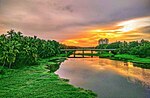
The climate is pleasant for most parts of the year, the exception is the summer months. There is sufficient rainfall and it receives more rainfall than the extreme southern districts of Kerala. The district has many small and medium rivers, which are tributaries of the Bharathapuzha River. A number of dams have been built across these rivers, the largest being the Malampuzha dam. The largest in volume capacity is the Parambikulam Dam Bhavani River, which is a tributary of Kaveri River, also flows through the district. Kadalundi River has its origin in Silent Valley National Park. The Chalakudy River also flows through district. Palakkad district have total number of seven municipalities.The largest city in the district is the Palakkad municipality. The municipalities in the district are Palakkad city, Ottapalam, Shornur, Chittur-Tattamangalam, Pattambi, Cherpulassery and Mannarkkad. Out of the total Palakkad District population for 2011 Census of India, 24.09 percent lives in urban regions of district. In total 676,810 people lives in urban areas of which males are 328,012 and females are 348,798. Sex Ratio in urban region of Palakkad District is 1063 as per 2011 Census of India data. Similarly child sex ratio in Palakkad District was 959 in 2011 census. Child population (0-6) in urban region was 70,405 of which males and females were 35,933 and 34,472. This child population figure of Palakkad district is 10.95% of total urban population.