Hawthorne, Louisville
1909 establishments in KentuckyJefferson County, Kentucky geography stubsLouisville, Kentucky stubsNeighborhoods in Louisville, KentuckyPopulated places established in 1909

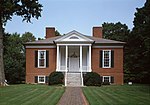
Hawthorne is a neighborhood in eastern Louisville, Kentucky, United States. Its boundaries are Taylorsville Road, Hawthorne Avenue, Bardstown Road and I-264. The land was once part of John Speed's Farmington estate, known for its plantation house built around 1815–16. The neighborhood is primarily residential and was first subdivided in 1909, but saw its fastest grown in the 1920s. It takes its name from Hawthorne Avenue, and most of the other streets are named after writers or poets. Sullivan University is located in the neighborhood. Hawthorne surrounds the small city of Wellington, Kentucky.
Excerpt from the Wikipedia article Hawthorne, Louisville (License: CC BY-SA 3.0, Authors, Images).Hawthorne, Louisville
Curran Road, Louisville
Geographical coordinates (GPS) Address Nearby Places Show on map
Geographical coordinates (GPS)
| Latitude | Longitude |
|---|---|
| N 38.219722222222 ° | E -85.664444444444 ° |
Address
Curran Road 3022
40205 Louisville
Kentucky, United States
Open on Google Maps


