place

Rosa Parks station (Paris)

Buildings and structures in the 19th arrondissement of ParisMemorials to Rosa ParksRailway stations in France opened in 2015Réseau Express Régional stationsWikipedia page with obscure subdivision
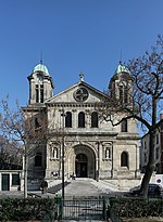
Gare Rosa Parks coté rue Gaston Tessier

Rosa Parks station (French: Gare Rosa Parks) is a railway station in the 19th arrondissement of Paris, France near the Porte d'Aubervilliers. It is on the RER network, and also has a tram stop. The station opened on 13 December 2015, and bears the name of American civil rights activist Rosa Parks.

Excerpt from the Wikipedia article Rosa Parks station (Paris) (License: CC BY-SA 3.0, Authors, Images).

Rosa Parks station (Paris)
Rue Gaston Tessier, Paris 19th Arrondissement (Paris)

Geographical coordinates (GPS) Address Nearby Places
placeShow on map

Wikipedia: Rosa Parks station (Paris)Continue reading on Wikipedia

Geographical coordinates (GPS)

Latitude Longitude
N 48.896388888889 ° E 2.3741666666667 °
placeShow on map

Address

Rue Gaston Tessier
75019 Paris, 19th Arrondissement (Paris)
Ile-de-France, France
mapOpen on Google Maps

Gare Rosa Parks coté rue Gaston Tessier
Share experience

Nearby Places

Canal Saint-Denis
Canal Saint-Denis

The Canal Saint-Denis is a canal in Paris, France that is 6.6 kilometres (4.1 mi) in length. The canal connects the Canal de l'Ourcq, at a point north-northwest of the Bassin de la Villette in the 19th arrondissement, with the suburban municipalities of Saint-Denis and Aubervilliers in the department of Seine-Saint-Denis. There are seven locks along the canal's route, and, near Saint-Denis, the canal discharges into the Seine.In 1802 Napoléon Bonaparte issued a decree for the construction of the canal to both expedite shipping and reduce the number of ships and barges sailing up and down the Seine through the center of Paris. Contracts to build and operate the canals in the Île-de-France were granted to private banking firms. These contracts required the city of Paris to purchase land, and the merchant-bankers who won the contracts, Roman Vassal, Lafitte, André, and Cottier, were expected to construct the waterways. As compensation for their large outlays, the bankers were permitted to collect tolls on the canal for a term of ninety-nine years. The canal was completed in 1821. The canal is part of the Réseau des Canaux Parisiens (Parisian Canal Network), a public-works authority operated by the city. The other components of the network are the Canal de l'Ourcq, the Bassin de la Villette, the Canal Saint-Martin, and the Bassin de l'Arsenal. Together, these canals and basins extend over a distance of 121 kilometres (75 mi).

Bassin de la Villette

The Bassin de la Villette (La Villette Basin) is the largest artificial lake in Paris. It was filled with water on 2 December 1808. Located in the 19th arrondissement of the capital, it links the Canal de l'Ourcq to the Canal Saint-Martin, and it represents one of the elements of the Réseau des Canaux Parisiens (Parisian Canal Network), a public-works authority operated by the city. The other components of the network are the Canal de l'Ourcq, the Canal Saint-Denis, the Canal Saint-Martin, and the Bassin de l'Arsenal. Together, these canals and basins extend roughly 130 kilometres (81 mi). Rectangular, eight hundred metres in length and seventy metres in width, it begins at the Rue de Crimée lifting bridge, the last bridge in Paris that can be raised and lowered hydraulically to permit the passage of ship and barge traffic beneath it, and it ends at the Place de la Bataille-de-Stalingrad near the Rotunda de la Villette. River cruise boats tie-up here and the shores of the basin are also the location of the MK2 Quai de Loire and MK2 Quai de Seine theatre complexes which are the most modern in France. A small electric passenger ferry, the Zéro de conduite, is available for transporting people from one side of the basin to the other. The basin is bordered in the north by the Quai de la Seine and in the south by the Quai de la Loire, which are linked in the middle of the basin by a footbridge, the Passerelle de la Moselle.