Saar-Nahe Hills
Geography of Rhineland-PalatinateGeography of SaarlandNatural regions of the South German Scarplands
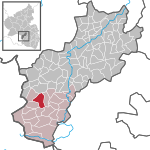
The Saar-Nahe Hills or Saar-Nahe Uplands (German: Saar-Nahe-Bergland or Saar-Nahe-Berg- und Hügelland) is a major natural region (major landscape unit group, level 3) in the German states of Rhineland-Palatinate and the Saarland. The region of hills and mountains covers an area of 4,185 km² (including the Sobernheim Valley) running from Saarbrücken, Kaiserslautern and the Palatine Forest in the south to the Hunsrück in the northeast. It contains the catchment area of the Nahe as far as Bad Kreuznach as well as small sections of the Middle Saar in the west.
Excerpt from the Wikipedia article Saar-Nahe Hills (License: CC BY-SA 3.0, Authors).Saar-Nahe Hills
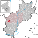
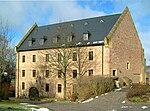
Wolfsborner Hof, Kusel-Altenglan
Geographical coordinates (GPS) Address Nearby Places Show on map
Geographical coordinates (GPS)
| Latitude | Longitude |
|---|---|
| N 49.522 ° | E 7.311 ° |
Address
Steinbruch am Steinberg
Wolfsborner Hof
66871 Kusel-Altenglan
Rhineland-Palatinate, Germany
Open on Google Maps

