Neutral Municipality

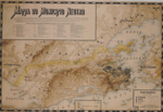
The Neutral Municipality (Portuguese: Município Neutro), more formally known in the imperial era as the Neutral Municipality of the Court (Município Neutro da Corte), in reference to the Imperial Court, was an administrative unit created in the Empire of Brazil, that existed in the territory corresponding to the current location of the municipality of Rio de Janeiro between August 12, 1834 (when it was proclaimed the Additional Act to the Constitution of 1824) and November 15, 1889, when was proclaimed the republic in Brazil. It only officially ceased to exist with the promulgation of the 1891 Constitution. Under the republican constitution, this administrative unit became the Federal District in 1891, which was abolished and transformed into the state of Guanabara in 1960, and later, with the fusion of this with the state of Rio de Janeiro in 1975.
Excerpt from the Wikipedia article Neutral Municipality (License: CC BY-SA 3.0, Authors, Images).Neutral Municipality
Rua dos Andradas, Rio de Janeiro Centro (Zona Central do Rio de Janeiro)
Geographical coordinates (GPS) Address Nearby Places Show on map
Geographical coordinates (GPS)
| Latitude | Longitude |
|---|---|
| N -22.9 ° | E -43.183333333333 ° |
Address
Rua dos Andradas 147
20081-190 Rio de Janeiro, Centro (Zona Central do Rio de Janeiro)
Rio de Janeiro, Brazil
Open on Google Maps


