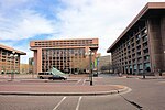
Inner Loop (Washington, D.C.)
Cancelled highway projects in the United StatesFreeways in the United StatesInfobox road instances in the District of ColumbiaInterstate 66Interstate 95 ... and 2 more
Roads in Washington, D.C.U.S. Route 50
The Inner Loop was two planned freeways around downtown Washington, D.C. The innermost loop would have formed an oval centered on the White House, with a central freeway connecting the southern segment to the northern segment and then continuing on to Interstate 95. Interstate 95 would have met Interstate 66, Interstate 295, Interstate 695, and US 50 while traversing the Inner Loop. A second loop was an arc across the northern section of the city, beginning at East Capitol Street at the Anacostia River and using the Missouri Avenue NW and Nebraska Avenue NW commercial corridors to terminate in Georgetown.
Excerpt from the Wikipedia article Inner Loop (Washington, D.C.) (License: CC BY-SA 3.0, Authors).Inner Loop (Washington, D.C.)
Southwest Freeway, Washington
Geographical coordinates (GPS) Address Nearby Places Show on map
Geographical coordinates (GPS)
| Latitude | Longitude |
|---|---|
| N 38.88225 ° | E -77.025111111111 ° |
Address
Southwest Freeway
Southwest Freeway
20410 Washington
District of Columbia, United States
Open on Google Maps


