place

Monte Vista Hotel

Harv and Sfn no-target errorsHotels in Los AngelesSunland-Tujunga, Los Angeles
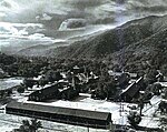
Monte Vista Hotel Sunland 1880s

The Monte Vista Hotel was a building which had been formerly located at the intersection of what today are Fenwick Street and Floralita Avenue in the Sunland-Tujunga district of Los Angeles. It was considered the first structure built in the district as well as the last surviving structure of a larger, pre-existing facility known as the Monte Vista Lodge.

Excerpt from the Wikipedia article Monte Vista Hotel (License: CC BY-SA 3.0, Authors, Images).

Monte Vista Hotel
Fenwick Street, Los Angeles Sunland

Geographical coordinates (GPS) Address Nearby Places
placeShow on map

Wikipedia: Monte Vista HotelContinue reading on Wikipedia

Geographical coordinates (GPS)

Latitude Longitude
N 34.261388888889 ° E -118.31777777778 °
placeShow on map

Address

Fenwick Street 8498
91040 Los Angeles, Sunland
California, United States
mapOpen on Google Maps

Monte Vista Hotel Sunland 1880s
Share experience

Nearby Places

Tuna Canyon Detention Station

Tuna Canyon Detention Station was a temporary detention facility used for holding hundreds of Japanese Americans who were considered enemy aliens by the U.S. government and to be risks to the nation's security. The detention camp was located in Tujunga at a former Civilian Conservation (CCC) Camp, constructed in 1933. The camp was converted into the Tuna Canyon Detention Station just after the bombing of Pearl Harbor. Administered by the Department of Justice, it opened on December 16, 1941, when the first group of detainees arrived from various Southern California towns and cities. Tuna Canyon had a capacity of 300, and until its closing in October 31, 1943, over 2,000 Japanese, German, and Italian immigrants, Japanese Peruvians, and others were imprisoned there. Most were transferred to other DOJ facilities like Fort Missoula, Fort Lincoln and Santa Fe. The site was used as a probation school after the war.In 1960, the property was sold and turned into the Verdugo Hills Golf Course. The Tuna Canyon Detention Station and camp sites are located in the southeastern area of the golf course, where the driving range and overflow parking were built.A portion of the former detention site, located at 6433 West La Tuna Canyon Road, was recognized as a Los Angeles Historic-Cultural Monument by the City of Los Angeles in 2013. A housing developer, Snowball West Investments, is attempting to build on the land, and it has filed a lawsuit to contest that recognition.

Chatsworth Calera
Chatsworth Calera

Chatsworth Calera also called Chatsworth Reservoir Kiln Site is one of the few surviving structures of the early 1800s lime industry. This kiln marked the introduction to California of the European industrial process for vitrifying limestone building blocks which were used in the construction of the San Fernando mission and other mission buildings. The word "Calera" is Spanish for "limestone quarry" or "limekiln". Chatsworth Calera is now located in Chatsworth, Los Angeles, California. in the Chatsworth Nature Preserve. At its peak there may have been up to five kilns at the site run by native Indian laborers. Chatsworth Calera registered a California Historical Landmark No. 911. The Chatsworth Calera is also a Los Angeles Historic-Cultural Monument #141, thus designated on April 2, 1975 by the Los Angeles Cultural Heritage Commission. The Chatsworth Calera kiln was used for burning limestone in the making of lime for concrete, mortar, and whitewash, a step in the construction of bricks and tiles. The monument site now looks like a hole in the ground with walls of vitrified limestone and brick. The pit measures about fifteen feet deep and six and a half feet across. The kiln was in use during early California history (Spanish/Mission and Mexican periods). The area rich with oak trees and lime deposits was ideal for kiln operation. Several lime kilns were in operation around the edge of the San Fernando Valley in the past. The Location is near the intersection of Woolsey Canyon Road and Valley Circle Blvd in Chatsworth about 9022 Valley Circle Blvd, Chatsworth, CA 91311. The kiln can be seen today looking east at the intersection.The ruins of the Chatsworth Calera came to public attention by environmental quality commissioner, Helen Treend, for the City of Los Angeles, . She learned about the kiln from Max Knapp a Chatsworth valley pioneer stonemason. William Warren Orcutt a geologist and paleontologist wrote about the limestone outcrops near his ranch Rancho Sombra del Roble. He believed these outcrops to be of especially good quality for lime production. Two mile south of Chatsworth Calera is the Dayton Canyon Kilns.