Sunland-Tujunga, Los Angeles
1907 establishments in CaliforniaCommunities in the San Fernando ValleyCrescenta ValleyNeighborhoods in Los AngelesPopulated places established in 1907 ... and 2 more
Sunland-Tujunga, Los AngelesUse mdy dates from January 2015

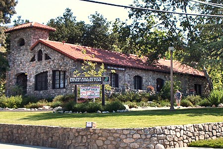
Sunland-Tujunga is a Los Angeles city neighborhood within the Crescenta Valley and Verdugo Mountains. Sunland and Tujunga began as separate settlements and today are linked through a single police station, branch library, neighborhood council, chamber of commerce, city council district, and high school. The merging of these communities under a hyphenated name goes back as far as 1928. Sunland-Tujunga contains the highest point of the city, Mount Lukens.
Excerpt from the Wikipedia article Sunland-Tujunga, Los Angeles (License: CC BY-SA 3.0, Authors, Images).Sunland-Tujunga, Los Angeles
Valmont Street, Los Angeles Tujunga
Geographical coordinates (GPS) Address Nearby Places Show on map
Geographical coordinates (GPS)
| Latitude | Longitude |
|---|---|
| N 34.25222 ° | E -118.2875 ° |
Address
Valmont Street 7139
91042 Los Angeles, Tujunga
California, United States
Open on Google Maps


