place

Conington, South Cambridgeshire

Cambridgeshire geography stubsCivil parishes in CambridgeshireSouth Cambridgeshire DistrictVillages in Cambridgeshire
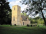
Conington Church geograph.org.uk 2270

Conington (Conington St Mary, or Coningtom-juxta-Cantab) is a small village in the South Cambridgeshire district of Cambridgeshire with about 50 houses and 150 residents. The population of the village is included in the civil parish of Elsworth. It lies about five miles (8km) south-east of Huntingdon and one mile south of the A14 road. The church is dedicated to the Assumption of St Mary. It has an oddly-buttressed steeple and houses one of the oldest bells in Britain, dated to around 1376. There are some pictures and a description of the church at the Cambridgeshire Churches website. The village has two ponds, one next to the church and the other near the Manor House. The pond near the church used to be used as a splash pond for washing cart wheels. The pond near the Manor House used to supply water for Conington Hall. The pond is notoriously deep, and claimed the lives of two young boys in the Victorian era, when they attempted to learn to swim across it using a rope. The rope snapped, and the boys drowned. Today the pond is known locally as Big Tree Corner. The village has a pub called The White Swan.

Excerpt from the Wikipedia article Conington, South Cambridgeshire (License: CC BY-SA 3.0, Authors, Images).

Conington, South Cambridgeshire
School Lane, South Cambridgeshire

Geographical coordinates (GPS) Address Nearby Places
placeShow on map

Wikipedia: Conington, South CambridgeshireContinue reading on Wikipedia

Geographical coordinates (GPS)

Latitude Longitude
N 52.277522 ° E -0.065704 °
placeShow on map

Address

School Lane

School Lane
CB23 4LP South Cambridgeshire
England, United Kingdom
mapOpen on Google Maps

Conington Church geograph.org.uk 2270
Share experience

Nearby Places

Fen Drayton
Fen Drayton

Fen Drayton is a small village between Cambridge and St. Ives in Cambridgeshire, England, and between the villages of Fenstanton and Swavesey. The village has a primary school, village hall, tennis courts and football fields, where Drayton Lions Football Club play their home matches, and a pub (The Three Tuns). The church (a Church of England) is dedicated to St Mary the Virgin. The village is close to the A14 and the Cambridgeshire Guided Busway, and is on National Cycle Route 51. According to the 2001 census, it is home to 827 people, living in some 329 dwellings. The population was nearly entirely white (99.3%), with 0.4% Asian/Asian British, and 0.4% of mixed ethnicity. 71.5% of the population were Christian, compared to 1.1% listed under 'other religion' (27.4% claimed 'no religion' or did not state a religion). The population of the civil parish as of the 2011 census is 856Much of the working population commutes to work in one of the larger towns or cities nearby; however, there are also a number of farms in the village, some still active. The village was one of 20 Land Settlement Association sites established in the 1930s to provide small holdings (around 5 acres of land each) for the growing of salad crops. When the scheme was wound up in 1983, Fen Drayton Growers was established as a cooperative to manage sales from the remaining growers. This was wound up in the 1990s, and most former holdings in the village are no longer productive sites.