place

Tauredunum event

5636th-century natural disastersHistory of GenevaLake GenevaLandslides in Switzerland
Medieval tsunamisNatural disasters in Switzerland
SwitzerlandGeneva
SwitzerlandGeneva

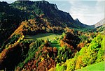
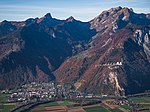
The Tauredunum event (German: Tauredunum-Ereignis) of 563 AD was a tsunami on Lake Geneva (then under the Frankish territory of the Kingdom of Orleans), triggered by a massive landslide which caused widespread devastation and loss of life along the lakeshore. According to two contemporary chroniclers, the disaster was caused by the collapse of a mountainside at a place called Tauredunum at the eastern end of Lake Geneva. It caused a great wave to sweep the length of the lake, sweeping away villages on the shoreline and striking the city of Geneva with such force that it washed over the city walls and killed many of the inhabitants. A study published in October 2012 suggests that the Tauredunum landslide triggered the collapse of sediments that had accumulated at the point where the River Rhône flows into Lake Geneva. This caused a huge underwater mudslide that displaced several hundred million cubic metres of sediment, producing a tsunami up to 16 metres (52 ft) high that reached Geneva within about 70 minutes. There is evidence of four previous mudslides, suggesting that tsunamis may be a recurrent phenomenon on Lake Geneva. It is also speculated that such an event could happen again, with far more severe consequences as more people live within potentially affected areas, and because most people are not accustomed to the idea of tsunamis happening in landlocked bodies of water and are thus unaware of the danger.

Excerpt from the Wikipedia article Tauredunum event (License: CC BY-SA 3.0, Authors, Images).

Tauredunum event
Port-Valais

Geographical coordinates (GPS) Address Nearby Places
placeShow on map

Wikipedia: Tauredunum eventContinue reading on Wikipedia

Geographical coordinates (GPS)

Latitude Longitude
N 46.3575 ° E 6.8519444444444 °
placeShow on map

Address


1897 Port-Valais
Wallis, Switzerland
mapOpen on Google Maps

SwitzerlandGeneva
SwitzerlandGeneva
Share experience

Nearby Places

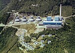
Thermal power plant of Vouvry

The thermal power plant of Vouvry, also known as the Chavalon Plant, is a former power station located in the municipality of Vouvry, in the canton of Valais, Switzerland. Until its closure in 1999, the plant utilized heavy fuel oil, combusted to heat a steam generator. The vaporized water then drove a turbine, which powered an alternator. As Switzerland's sole oil-fired power plant, it was constructed in 1965 by a consortium led by the company Énergie de l'Ouest-Suisse (EOS) to address the wintertime electricity production deficits of Swiss hydropower. Initially planned on the territory of the commune of Aigle in the canton of Vaud, it benefited from its proximity to the Collombey refinery, enabling it to produce electricity at preferential rates. However, by the late 1990s, the plant operation had generated significant financial losses, leading the operators to decommission the site. Since then, several rehabilitation projects have been proposed, but the plant remains abandoned. The plant site, situated approximately 450 meters above the plain, was constructed to limit pollution. It consists of two plateaus and a slope and includes a main building housing the machine room, a 120-meter exhaust chimney, four cooling towers, a cable car station, and 17 villas, which Chavalon employees previously inhabited. The plant is connected to the Collombey refinery by a pipeline that primarily traverses the Stockalper Canal, which was utilized to provide makeup water. The generated electricity was fed into the Swiss power grid via a 220 kV high-voltage line.