place

Rolling Hills Country Day School

1961 establishments in CaliforniaAll Wikipedia neutral point of view disputesEducational institutions established in 1961Private elementary schools in CaliforniaPrivate middle schools in California
Schools in Los Angeles County, CaliforniaWikipedia neutral point of view disputes from October 2012
Rolling Hills Country Day School

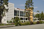
Rolling Hills Country Day School is a nonsectarian independent Kindergarten to Grade 8 school located in Rolling Hills Estates on the Palos Verdes Peninsula in Los Angeles County, California. The school is a for-profit school, owned by the school administration, the director and vice principal hold majority shares.

Excerpt from the Wikipedia article Rolling Hills Country Day School (License: CC BY-SA 3.0, Authors, Images).

Rolling Hills Country Day School
Crenshaw Boulevard,

Geographical coordinates (GPS) Address Nearby Places
placeShow on map

Wikipedia: Rolling Hills Country Day SchoolContinue reading on Wikipedia

Geographical coordinates (GPS)

Latitude Longitude
N 33.783333333333 ° E -118.35111111111 °
placeShow on map

Address

Crenshaw Boulevard
90275 , Rolling Hills Estates
California, United States
mapOpen on Google Maps

Rolling Hills Country Day School
Share experience

Nearby Places

South Coast Botanic Garden

The South Coast Botanic Garden is a 87 acres (35 ha) botanical garden in the Palos Verdes Hills, in an unincorporated area of Los Angeles County, California, United States, about 10 miles (16 km) south of Los Angeles International Airport. It has over 150,000 landscaped plants and trees from approximately 140 families, 700 genera, and 2,000 different species, including flowering fruit trees, Coast Redwoods, Ginkgos and Pittosporum. It is particularly rich in plants from Australia and South Africa. Its gardens include the Water-wise Garden, Herb Garden, English Rose Garden, and Garden of the Senses. A small lake and stream bed attract various birds such as ducks, geese, coots, and herons. Over 300 species of birds have been recorded. The lake is currently empty. The site was operated as an open pit mine from 1929 until 1956, producing over one million tons of crude diatomite. With declining production, the land was sold in 1957 to the County of Los Angeles for a sanitary landfill, which was in use until 1965. Starting in 1961, an experiment in land reclamation began when County Board of Supervisors approved a motion establishing the site as the South Coast Botanic Garden, which was landscaped over 3.5 million tons of refuse, in an example of land recycling. The Sanitation District in cooperation with other County agencies carried out initial planning, grading and contouring. Operating responsibilities were given to the Los Angeles County Department of Arboreta and Botanic Gardens. In April 1961, the first large-scale planting took place on completed fill overlooking Rolling Hills Road, with over 40,000 plants donated by individuals, nurseries and the County Arboretum. The site presents unusual difficulties in gardening. First, its soil is composed almost entirely of diatomaceous earth. Second, because of the diverse nature and thickness of the fill, settling rates vary throughout the garden resulting in frequent irrigation system breakage. Third, heat is caused by decomposition of organic matter below the soil surface, and it is accompanied by the production of gases, primarily carbon dioxide and methane.

José Dolores Sepúlveda Adobe

Jose Dolores Sepulveda Adobe is an adobe home built in 1818. It is located at the Rancho de los Palos Verdes in Torrance, California. The Jose Dolores Sepulveda Adobe was designated a California Historic Landmark (No. 383) on Jan. 03, 1944. The Jose Dolores Sepulveda Adobe was built by José Dolores Sepúlveda de Redondo, his son was Mayor of Los Angeles from 1837 to 1848. José Dolores Sepúlveda's father was José Loreto Sepúlveda (1764–1808). The location is now a private residence in Torrance. The original Adobe is gone, but the current homeowner renovated the house to reflect the Rancho history. Rancho de los Palos Verdes means "range of green trees". The Rancho is now the present-day cities of the Palos Verdes Peninsula, as well as portions of San Pedro and Torrance.José Dolores Sepúlveda (March 23, 1793–1824) was one of the sons of Juan José Sepúlveda (1764–1808). In 1784, the Spanish Crown deeded Rancho San Pedro, a tract of over 75,000 acres (300 km2), to soldier Juan José Domínguez. Domínguez died in 1809, and in 1810 the executor of his will, Manuel Gutiérrez, granted permission to then 17-year-old Sepúlveda to herd livestock in the southwestern reaches of Rancho San Pedro. This eventually became the basis for the Sepúlveda family's contested claim to the Rancho de los Palos Verdes, carved out of Rancho San Pedro lands. Dolores went to Monterey to settle his land title, but on his return trip in 1824 he was killed in the Chumash revolt at Mission La Purísima Concepción. In 1834, Governor José Figueroa made a judicial decree intended to settle the dispute between the Domínguez and Sepúlveda families, awarding the 31,629-acre (128 km2) Rancho de los Palos Verdes to Juan Capistrano Sepúlveda and José Loreto Sepúlveda. José Dolores Sepúlveda married María Ignacia Marcia Ávila (1793 - ?) on November 8, 1813, at Mission San Gabriel Arcángel.

Chowigna, California

Chowigna (also, Unaungna) is a former Tongva-Gabrieleño Native American settlement in Los Angeles County, California.It was located in modern-day Palos Verdes, Palos Verdes Peninsula.Name variations include: Chowiinga, Chowi, Unaungna, Chowigna, and Chowingna (near San Pedro).The Chowigna Village site at Malaga Cove has been inhabited for at least 7,100 years. It was first described by the Cabrillo Expedition in 1542. It was excavated in 1936-37 by the Southwest Museum of the Native Americans and the University of Southern California. Among the thousands of artifacts retrieved were "arrowheads, mortars and pestles, scrapers and spoons made from abalone, beads and art objects, bone tools, shells," including olivella and giant keyhole limpet shells, "and bones from food animals like mussels and birds ... An estimated 150 people lived at the site in its last days, about 1775." "The site stratigraphy and material culture assemblage provided the central framework of early cultural chronological sequences for the region."Artifacts of the Chowigna Native Americans are held by the Southwest Museum of the Native Americans and the Redondo Beach Historical Museum.The Chowigna Natives used the site of today's Hopkins Wilderness Park, formerly Nike missile site LA-57 from 1956 to 1963, in Redondo Beach as a lookout place. The wetlands located at the site of today's AES power plant in Redondo Beach were a source of foods including halibut, lobster, and sea bass, and also of salt. In the 18th century, the Chowigna bartered salt from the old Redondo Salt Lake, "a spring-fed salt lake about 200 yards wide and 600 yards long situated about 200 yards from the ocean", with other tribes. Their village by the lake was called "Onoova-nga", or "Place of Salt." The Chowigna were relocated to missions in 1854, when Manuel Dominguez sold 215 acres of Rancho San Pedro, including the lake, to Henry Allanson and William Johnson for the Pacific Salt Works.The Chowigna rancheria was associated with the Mission San Gabriel Arcángel.