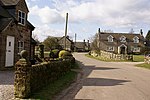
Stanton, Staffordshire
Borough of East StaffordshireUse British English from May 2015

Stanton is a small village situated at the eastern end of the Weaver Hills, Staffordshire, England. Stanton is located 146 miles (235.0 km) north-west of London and 18.4 miles (29.6 km) east of Stoke-on-Trent. It has a population of 232 according to the 2001 Census. The landscape around the village is mainly pastureland bounded by dry stone walls.
Excerpt from the Wikipedia article Stanton, Staffordshire (License: CC BY-SA 3.0, Authors, Images).Stanton, Staffordshire
Sallyfield Lane, East Staffordshire Stanton
Geographical coordinates (GPS) Address Nearby Places Show on map
Geographical coordinates (GPS)
| Latitude | Longitude |
|---|---|
| N 53.012 ° | E -1.81 ° |
Address
Sallyfield Lane
Sallyfield Lane
DE6 2DD East Staffordshire, Stanton
England, United Kingdom
Open on Google Maps


