Offenbach-Rosenhöhe

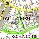
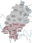
Rosenhöhe (or Rosenhoehe) is one of the 21 boroughs of Offenbach am Main, Germany. It is the city's southernmost borough and the second smallest by population with only 1,396 inhabitants. Until 2019 it was one of the nine officially recognized boroughs. When in July 2019 the city council approved a bill to fully divide the city's area into boroughs, Rosenhöhe became the second largest by area after Bieber. The total area is 7,08 km2 (2,73 sq mi). Rosenhöhe borders the boroughs of Carl-Ulrich-Siedlung and Lauterborn in the north, Buchrain in the west and Tempelsee in the east. The southern border of Rosenhöhe is shared with the Offenbach city limits, bordering the towns of Neu-Isenburg, Dreieich and Heusenstamm. Most of its area is occupied by forests and is a landscape preservation area. Built-up area is only found in the northern tip of the borough.
Excerpt from the Wikipedia article Offenbach-Rosenhöhe (License: CC BY-SA 3.0, Authors, Images).Offenbach-Rosenhöhe
Gravenbruchweg, Offenbach am Main Rosenhöhe
Geographical coordinates (GPS) Address Nearby Places Show on map
Geographical coordinates (GPS)
| Latitude | Longitude |
|---|---|
| N 50.0789 ° | E 8.7611 ° |
Address
BSC Offenbach
Gravenbruchweg
63069 Offenbach am Main, Rosenhöhe
Hesse, Germany
Open on Google Maps


