Delabole railway station
Beeching closures in EnglandDisused railway stations in CornwallFormer London and South Western Railway stationsPages with no open date in Infobox stationRailway stations in Great Britain closed in 1966 ... and 2 more
Railway stations in Great Britain opened in 1893Use British English from March 2018

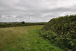
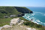
Delabole railway station (Cornish: Delyow Boll) was a railway station that served a quarry, rural district, and village of Delabole, situated approximately two miles (3 km) west of Camelford in north Cornwall, England, UK. It was located on the North Cornwall Railway and named after Delabole Quarry. There were three hamlets in the vicinity, Pengelly, Meadrose, and Rockhead, while the hamlet of Delabole was south of the quarry.
Excerpt from the Wikipedia article Delabole railway station (License: CC BY-SA 3.0, Authors, Images).Delabole railway station
The Sidings,
Geographical coordinates (GPS) Address Nearby Places Show on map
Geographical coordinates (GPS)
| Latitude | Longitude |
|---|---|
| N 50.6226 ° | E -4.7268 ° |
Address
The Sidings
The Sidings
PL33 9AX
England, United Kingdom
Open on Google Maps


