Delabole
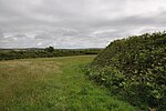
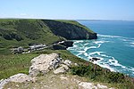
Delabole (Cornish: Delyow Boll) is a large village and civil parish in north Cornwall, England, UK. It is situated approximately two miles (3 km) west of Camelford.The village of Delabole came into existence in the early 20th-century; it is named after the Delabole Quarry. Three hamlets: Pengelly, Meadrose (pronounced "médroze") and Rockhead, and the hamlet of Delabole south of the quarry are shown on the earliest one-inch Ordnance Survey map of 1813. When the railway arrived, the station was named Delabole after the quarry, and the three hamlets were absorbed into Delabole. It is said to be the third highest village in Cornwall. Treligga military airfield and HMS Vulture II, an aerial bombing and gunnery range, were situated west of the village. Delabole lies within the Cornwall Area of Outstanding Natural Beauty (AONB).
Excerpt from the Wikipedia article Delabole (License: CC BY-SA 3.0, Authors).Delabole
Westdown Road,
Geographical coordinates (GPS) Address Nearby Places Show on map
Geographical coordinates (GPS)
| Latitude | Longitude |
|---|---|
| N 50.622 ° | E -4.733 ° |
Address
Westdown Road
PL33 9AH
England, United Kingdom
Open on Google Maps


