place

Glenwood Cemetery (Washington, D.C.)

1854 establishments in Washington, D.C.Art Nouveau architecture in Washington, D.C.Art Nouveau cemeteriesBurials at Glenwood Cemetery (Washington, D.C.)Cemeteries in Washington, D.C.
Cemeteries on the National Register of Historic Places in Washington, D.C.
Entrance Glenwood Cemetery 2014 09 14

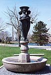
Glenwood Cemetery is a historic cemetery located at 2219 Lincoln Road NE in Washington, D.C. It is a private, secular cemetery owned and operated by The Glenwood Cemetery, Inc. Many famous people are buried in Glenwood Cemetery, and the cemetery is noted for its numerous elaborate Victorian and Art Nouveau funerary monuments. The cemetery was listed on the National Register of Historic Places in 2017; its mortuary chapel was separately listed in 1989.

Excerpt from the Wikipedia article Glenwood Cemetery (Washington, D.C.) (License: CC BY-SA 3.0, Authors, Images).

Glenwood Cemetery (Washington, D.C.)
Bryant Street Northeast, Washington

Geographical coordinates (GPS) Address Nearby Places
placeShow on map

Wikipedia: Glenwood Cemetery (Washington, D.C.)Continue reading on Wikipedia

Geographical coordinates (GPS)

Latitude Longitude
N 38.9229 ° E -77.006 °
placeShow on map

Address

Glenwood Cemetery Mortuary Chapel

Bryant Street Northeast
20002 Washington
District of Columbia, United States
mapOpen on Google Maps

Entrance Glenwood Cemetery 2014 09 14
Share experience

Nearby Places

Trinity Washington University

Trinity Washington University is a private university in Washington, D.C. affiliated with the Catholic Church. Trinity is a comprehensive university with five schools; the undergraduate College of Arts & Sciences maintains its original mission as a liberal arts women's college, while men attend Trinity's other schools at both the graduate and undergraduate level. The university was founded as Trinity College by the Sisters of Notre Dame de Namur in 1897 as the nation's first Catholic liberal arts college for women. Trinity was chartered by an Act of Congress on August 20, 1897. An elite institution in its early life, the college faced declining enrollment by the 1980s. It chose to begin recruiting local underprivileged students, and became predominantly black and Hispanic. Trinity became Trinity Washington University in 2004. Today, Trinity Washington University enrolls more than 1,800 students in its undergraduate and graduate programs in the College of Arts and Sciences, School of Nursing and Health Professions, School of Education, School of Business and Graduate Studies and School of Professional Studies. Trinity enrolls more District of Columbia residents than any other private university in the city and in the nation – more than half of Trinity’s students are residents of the D.C. Trinity’s student body in 2020 includes about 95% ethnic minorities, including about 65% Black/African American and 30% Latina/Hispanic. Trinity is designated by the U.S. Department of Education as a Minority Serving Institution and is the only university in the D.C. region, and one of only a few in the nation, designated as both a Predominantly Black Institution and Hispanic Serving Institution.

McMillan Sand Filtration Site

McMillan Sand Filtration Site is a twenty-five acre decommissioned water treatment plant in northwest Washington, D.C., built as part of the historic McMillan Reservoir Park. It is bound on the north by Michigan Avenue, on the east by North Capitol Street, on the south by Channing Street and on the west by McMillan Drive; which runs along the edge of the reservoir, to which it was formerly attached. Two paved courts lined by regulator houses, tower-like sand bins, sand washers and the gated entrances to the underground filter cells provided a promenade for citizens taking the air in the park before it was fenced off in WWII. Below grade, there are twenty catacomb-like cells, each an acre in extent, where sand was used to filter water from the Potomac River by way of the Washington Aqueduct. The purification system was a slow sand filter design that became obsolete by the late 20th century. In 1985, a new rapid sand filter plant replaced it across First Street beside the reservoir. The treatment system is operated by the Army Corps of Engineers. Public access to the site has been restricted since World War II, when the Army erected a fence to guard against sabotage of the city's water supply. Until recently, specially arranged biannual tours were arranged for scores of visitors curious about the odd-looking structures. The site was never reopened to the public on the same basis as before the war. In 1991, the D.C. Historic Preservation Review Board designated McMillan Park a Historic Landmark and nominated the site for the National Register of Historic Places. It included the site on their "List of Most Endangered Properties in 2000" and again in 2005.

Rhode Island Avenue
Rhode Island Avenue

Rhode Island Avenue is a diagonal avenue in the Northwest and Northeast quadrants of Washington, D.C. and the capital's inner suburbs in Prince George's County, Maryland. Paralleling New York Avenue, Rhode Island Avenue was one of the original streets in Pierre L'Enfant's plan for the capital. It became a major commuter route, carrying U.S. Route 1 traffic into the city from Prince George's County. The western terminus of Rhode Island Avenue is in downtown Washington, at an intersection with Connecticut Avenue NW and M Street NW. The Cathedral of St. Matthew the Apostle is on Rhode Island Avenue NW, just east of that intersection. Just east of the cathedral, at Scott Circle, Rhode Island Avenue NW intersects Massachusetts Avenue NW and 16th Street NW. N Street NW stops short of meeting the circle from either direction, but is instead connected to Rhode Island and Massachusetts avenues NW through two short streets, Corregidor Street NW and Bataan Street NW. From Scott Circle, Rhode Island Avenue NW continues eastward to the Logan Circle neighborhood. At the traffic circle of the same name, Rhode Island Avenue NW intersects Vermont Avenue, 13th Street, and P Street NW. East of Logan Circle, Rhode Island passes through primarily residential neighborhoods such as Bloomingdale, Shaw and Brentwood. Rhode Island Avenue is U.S. Route 29 between 7th and 11th streets NW, and U.S. Route 1 east of 6th Street NW. In Northeast Washington, Rhode Island Avenue NE is served by the Rhode Island Avenue–Brentwood station on the Red Line and the Shaw–Howard University station on the Green Line of the Washington Metro. In 1926, Rhode Island Avenue NE was extended from the District line into Maryland, through Mount Rainier, Brentwood, and North Brentwood.In downtown Hyattsville, Rhode Island Avenue merges into Baltimore Avenue (U.S. Route 1 Alternate). U.S. Route 1 traffic continues north on Baltimore Avenue. Discontinuous segments of Rhode Island Avenue exist in Riverdale Park, College Park, and Beltsville.