Ambergau
Natural regions of the Weser-Leine UplandsRegions of Lower Saxony

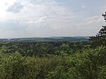
The Ambergau is a historic landscape and natural region unit in the Innerste Uplands in southern Lower Saxony, Germany. It is a basin, about 10 x 10 kilometres across, with 18 settlements (there were 31 in the Middle Ages), the centre and capital of which since the 13th century is the town of Bockenem. The basin, with its fertile agricultural fields, is surrounded by the wooded ridges of Heber, the Harplage, the Weinberg and the Hainberg. The Gau is a cultural landscape that was formed as early as the 8th century.
Excerpt from the Wikipedia article Ambergau (License: CC BY-SA 3.0, Authors, Images).Ambergau
Nettetalbahn,
Geographical coordinates (GPS) Address Nearby Places Show on map
Geographical coordinates (GPS)
| Latitude | Longitude |
|---|---|
| N 51.966666666667 ° | E 10.133333333333 ° |
Address
Nettetalbahn
Nettetalbahn
31167
Lower Saxony, Germany
Open on Google Maps


